Serere
Serere is a town in Eastern Uganda. It is the chief political, administrative and commercial town in Serere District, and the district headquarters are located there. The district is named after the town.
Serere
Serere Municipality | |
|---|---|
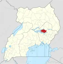
 Serere Location in Uganda | |
| Coordinates: 01°30′00″N 33°33′00″E | |
| Country | |
| Region | Eastern Uganda |
| Sub-region | Teso sub-region |
| District | Serere District |
| Elevation | 1,085 m (3,560 ft) |
| Population (2010 Estimate) | |
| • Total | 12,700 |
Location
Serere lies in Serere District, Teso sub-region, in Uganda's Eastern Region. The town is located approximately 35 kilometres (22 mi) south of Soroti, the largest town in the sub-region.[1] This location lies approximately 117 kilometres (73 mi), by road, northwest of Mbale, the nearest large city.[2] The coordinates of Serere are:1°30'00.0"N, 33°33'00.0"E (Latitude:1.5000; Longitude:33.5500).[3]
Population
As of May 2014, the exact population of Serere is not known. However, it is estimated that within a radius of 7 kilometres (4.3 mi), from the town center, the population is about 12,700.[4]
Points of interest
The following points of interest are found in Serere:
- The headquarters of Serere District Administration
- The offices of Serere Town Council
- Serere Central Market
- Serere Agricultural Research Station - An agricultural research institute administered by the Uganda Ministry of Agriculture
- Serere Township Secondary School
References
- "Road Distance Between Soroti And Serere With Map". Globefeed.com. Retrieved 27 May 2014.
- "Map Showing Mbale And Serere With Distance Marker". Globefeed.com. Retrieved 27 May 2014.
- "Location of Serere At Google Maps". Google Maps. Retrieved 27 May 2014.
- "Estimated Population of Serere Sub-county In 2014". Fallingrain.com. Retrieved 27 May 2014.