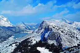
Serra de Tramuntana
The Serra de Tramuntana (Catalan pronunciation: [ˈsɛrə ðə tɾəmunˈtanə], Spanish: Sierra de Tramontana) is a mountain range running southwest–northeast which forms the northern backbone of the Spanish island of Mallorca. It is also the name given to the comarca of the same area. On 27 June 2011, the Tramuntana Range was awarded World Heritage Status by UNESCO as an area of great physical and cultural significance.
| UNESCO World Heritage Site | |
|---|---|
 | |
| Official name | Cultural Landscape of the Serra de Tramuntana |
| Location | Majorca, Spain |
| Criteria | Cultural: (ii), (iv), (v) |
| Reference | 1371 |
| Inscription | 2011 (35th session) |
| Area | 30,745 ha (75,970 acres) |
| Buffer zone | 78,617 ha (194,270 acres) |
| Coordinates | 39°43′51″N 2°41′41″E |
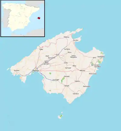 Location of Serra de Tramuntana in Majorca  Serra de Tramuntana (Spain) | |
Geography
The highest peak is the Puig Major, which at 1,445 metres, is the highest mountain in the Balearic Islands. It is closely followed by the Puig de Massanella, which stands at 1,364 metres.
The climate in the Tramuntana Range is significantly wetter than the rest of the island, recording as much as 1507 mm (59.3 inches) of precipitation per year, in comparison with some other parts of the island where annual rainfall is less than 400mm (15 inch). It is also cooler due to the altitude, and a few days of snow are not unusual during winter.
The Serra de Na Burguesa is the southernmost portion of the Tramuntana Range.
Coll de Cal Reis
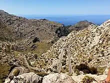
Coll de Cal Reis is a mountain saddle in the Serra de Tramuntana range on the Ballearic Island of Mallorca. To the west of the saddle a ridge extends up to the highest point of the island, the Puig Major, whilst east of the saddle, there is only a minor side peak, the Moleta de Cals Reis.
The highway Ma-2141 leads over the saddle down to the beach town of Sa Calobra, one of the supposed most picturesque roads of Spain.[1] The road is also a famous target for road cyclists.[2]
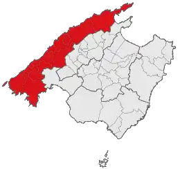
Municipalities in the region
| Municipality | Population | Surface area (km2) |
Population density (persons per km2) |
|---|---|---|---|
| Andratx | 11,348 | 81.45 | 139.3 |
| Banyalbufar | 627 | 18.05 | 34.7 |
| Bunyola | 5,910 | 84.63 | 69.8 |
| Calvià | 50,777 | 144.97 | 350.3 |
| Deià | 754 | 15.12 | 49.9 |
| Escorca | 276 | 139.33 | 2.0 |
| Esporles | 4,696 | 35.27 | 133.1 |
| Estellencs | 388 | 13.39 | 29.0 |
| Fornalutx | 732 | 19.49 | 37.6 |
| Pollença | 16,997 | 151.44 | 116.4 |
| Puigpunyent | 1,763 | 42.28 | 41.7 |
| Sóller | 13,625 | 42.75 | 318.7 |
| Valldemossa | 1,977 | 42.84 | 46.2 |
Population as at 1 January 2008
Environmental protection
In June 2011, the entire mountain range, which has been preserved as an important nature reserve, outstanding in their geology and forest cover and harboring a diversity of plant and animal species, away from rapid urbanization, was listed as a World Heritage Site by UNESCO. The UNESCO introductory statement refers to:
The Cultural Landscape of the Serra de Tramuntana located on a sheer-sided mountain range parallel to the north-western coast of the island of Mallorca. Millennia of agriculture in an environment with scarce resources has transformed the terrain and displays an articulated network of devices for the management of water revolving around farming units of feudal origins. The landscape is marked by agricultural terraces and inter-connected water works - including water mills - as well as dry stone constructions and farms.[3]
References
- Davies, Bryn (18 September 2017). "CARRETERA DE SA CALOBRA: THE BEST ROAD IN SPAIN?". Adventure Bike Rider. Retrieved 14 September 2018.
- https://www.tramuntanacycling.com/en/climbs-routes/the-best-climbs/item/col-dels-reis-from-sa-calobra
- UNESCO statement
External links
 Serra de Tramuntana travel guide from Wikivoyage
- Serra de Tramuntana - UNESCO World Heritage status 2010, Cultural Landscape (in Catalan, Spanish, and English)
- Information on the Serra de Tramuntana (in Catalan)
- Serra de Tramuntana of Mallorca, World Heritage Site
- Serra de Tramuntana - Facebook
- Serra de Tramuntana - Twitter
Comarcas of the Balearic Islands | ||
|---|---|---|
| ||