Sestranska Vas
Sestranska Vas (pronounced [sɛˈstɾaːnska ˈʋaːs], Slovene: Sestranska vas, German: Sestranskawas[2]) is a former village in northwestern Slovenia in the Municipality of Gorenja Vas–Poljane. It is now part of the town of Gorenja Vas.[3] It is part of the traditional region of Upper Carniola and is now included in the Upper Carniola Statistical Region.
Sestranska Vas | |
|---|---|
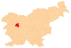
 Sestranska Vas Location in Slovenia | |
| Coordinates: 46°06′17″N 14°08′30″E | |
| Country | |
| Traditional region | Upper Carniola |
| Statistical region | Upper Carniola |
| Municipality | Gorenja Vas–Poljane |
| Elevation | 402 m (1,319 ft) |
Geography
Sestranska Vas lies on the right bank of the Poljane Sora River,[3] between the former village of Trata to the southwest and the old center of Gorenja Vas to the northeast.[1]
Name
Sestranska Vas was attested in Latin in 1291 as in Polan ex altera parte aque 'on the other side of the water in [the Parish of] Poljane',[4] and in German in the 18th century as Schwesterdorf (literally, 'sister village').[5][6] The name Sestranska Vas is related to the frequent Slovenian toponym Stranska vas (literally, 'side village'), and it either refers to a place of secondary importance in comparison to a nearby larger and older settlement[4] or indicates its location on the (other) side of the river.[7]
History
Sestranska Vas was annexed by the town of Gorenja Vas in 1953, ending its existence as an independent settlement.[8]
References
- Krajevni leksikon Dravske Banovine. 1937. Ljubljana: Zveza za tujski promet za Slovenijo, p. 585.
- Intelligenzblatt zur Laibacher Zeitung, no. 141. 24 November 1849, p. 9.
- Savnik, Roman (1968). Krajevni leksikon Slovenije, vol. 1. Ljubljana: Državna založba Slovenije. p. 360.
- Kos, Milko (1966). "'Vas' in 'selo' v zgodovini slovenske kolonizacije". Razprave 1. razreda SAZU (Hauptmannov zbornik). 5: 77–98.
- Josephinische Landesaufnahme 1763-1787 für das Gebiet der Republik Slowenien. Ljubljana: Znanstvenoraziskovalni center Slovenske akademije znanosti in umetnosti. 1995. p. 159.
- Slovenija na vojaškem zemljevidu 1763-1787: Sekcije. Ljubljana: Znanstvenoraziskovalni center Slovenske akademije znanosti in umetnosti. 1998. p. 277.
- Pintar, Luka (1912). "O krajnih imenih". Ljubljanski zvon. 32 (32): 661. Retrieved February 2, 2021.
- Marinković, Dragan (1991). Abecedni spisak naselja u SFRJ. Promene u sastavu i nazivima naselja za period 1948–1990. Belgrade: Savezni zavod za statistiku. pp. 32, 92.