Sha Tin
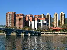
Sha Tin, also spelt Shatin, is a neighbourhood along Shing Mun River in the eastern New Territories, Hong Kong. Administratively, it is part of the Sha Tin District. Sha Tin is one of the neighbourhoods of the Sha Tin New Town project.
Sha Tin
沙田 | |
|---|---|
neighbourhood | |
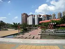
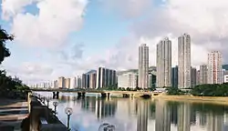 Shing Mun River Promenade | |
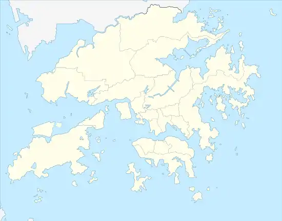 Sha Tin Location within Hong Kong | |
| Coordinates: 22°22′30″N 114°11′00″E | |
| Country | China |
| Provincial-level SAR | Hong Kong |
| Region | New Territories |
| District | Sha Tin District |
| Town | Sha Tin New Town |
| Demonym(s) | Shatinian |
| Time zone | UTC+8 (Hong Kong Time) |
| Sha Tin | |||||||||
|---|---|---|---|---|---|---|---|---|---|
 | |||||||||
| Chinese | 沙田 | ||||||||
| Literal meaning | Sandy Field | ||||||||
| |||||||||
The new town was founded in 1973 under the New Towns Development Programme of the Hong Kong government. Its current name was named after the nearby village of Sha Tin Wai.
History
Tai Wai Village, located in Tai Wai, next to Sha Tin, and the oldest and largest walled village in Sha Tin District, was built in 1574, during the Ming Dynasty.
Before British rule in Hong Kong, the area of Sha Tin and its vicinity was referred to as Lek Yuen (lit. "source of trickling" or "source of clear water"). Colonial officials allegedly mistook the name of the Sha Tin Wai village as the name of the area and it has been used ever since. Nowadays, the original name is used to refer to Lek Yuen Estate.
There was a market township Sha Tin Hui at the present location of Sha Tin Centre Street and New Town Plaza shopping centre, near the Sha Tin station of the MTR East Rail line.
Sha Tin was the location of the first flight of a powered aircraft in Hong Kong in 1911. The aeroplane was named as the Spirit of Sha Tin (沙田精神號). A full size replica of this plane now hangs in Hong Kong International Airport.
The area was formerly agricultural farmland. Before Sha Tin's development into a new town, Hung Mui Kuk (紅梅谷), southwest of Sha Tin, was perennially the main site for school picnics. The hillside area remains a popular barbecue site.
Starting in the 1970s, the area became part of the Sha Tin New Town development. Since then, the economy in the area has greatly improved and living standards have also increased. Sha Tin Town Centre was developed during the mid-1980s to help "link the town's currently dispersed residents into one cohesive community."[1] The 18-hectare site, adjacent to the railway station, was built up in stages to house an array of uses including the New Town Plaza, numerous smaller shopping centres, Sha Tin Park, magistracy, library, town hall, marriage registry, hotel, New Town Tower, a town square, and residential towers.
Geography
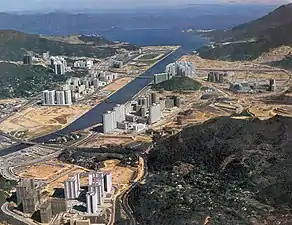
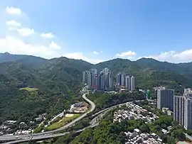
Sha Tin is located in a valley, on both sides of the Shing Mun River, running from the southwest to the northeast. It is bordered by Tai Wai in the southwest and by Fo Tan (left bank) and Shek Mun (right bank) in the northeast.
Cross-border activities
Due to their proximity to the Shenzhen border, towns in the northern parts of Hong Kong, notably Sheung Shui and Yuen Long, have become hubs for parallel traders who have been buying up large quantities of goods, forcing up local prices and disrupting the daily lives of local citizens.[2][3] Since 2012, there has been an increase in mainland parallel traders arriving in the North District of Hong Kong to re-export infant formula and household products – goods popular with mainlanders – across the border to Shenzhen.[4] The volume of smuggling activity spilled over into Tuen Mun and Sha Tin in 2014.
The first anti-parallel trading protest was started at Sheung Shui in September 2012.[5] As government efforts to limit the adverse impact of mainland trafficking were widely seen as inadequate, so there have been further subsequent protests in towns in the North District including Sha Tin.[6][7]
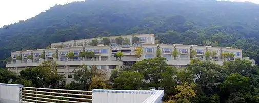
Housing
Public housing estates
Private housing estates
Private housing estates in Sha Tin include:
- City One
- Lucky Plaza
- Sha Tin Centre
- Wai Wah Centre
- Sha Tin Plaza
- Garden Rivera (河畔花園)
- Fung Shing Court
- Belair Gardens
- Castello, Hong Kong
Villages

South bank of Shing Mun River. From west to east:
- Sha Tin Tau
- Tsang Tai Uk
- Tsok Pok Hang
- Fui Yiu Ha New Village
- Sha Tin Wai
- Wong Uk
- To Shek
- Chap Wai Kon
- Ngau Pei Sha
North bank of Shing Mun River. From west to east:
Shopping centres
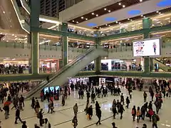
- New Town Plaza (新城市廣場)
- Citylink Plaza (連城廣場)
- Sha Tin Plaza (沙田廣場)
- Sha Tin Centre (沙田中心)
- Lucky Plaza (好運中心)
- Hilton Plaza (希爾頓中心)
- Wai Wah Centre (偉華中心)
- Fortune City One (置富第一城)
- Grand Central Plaza - HomeSquare (新城市中央廣場)
Notable places of worship
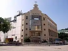
- Sai Lam Temple (西林寺)[9]
- Sam Yuen Temple (三元宮)
- Wai Chuen Monastery (慧泉寺)
- Dao Hop Yuen (道合園)
- Ten Thousand Buddhas Monastery (萬佛寺)
- Tao Fung Shan Christian Centre (道風山基督教叢林)
- International Fellowship North, English speaking Christian church in Siu Lek Yuen.[10]
- Shatin Baptist Church (沙田浸信會)
- Shatin Anglican Church
Health
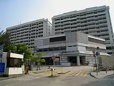
The Prince of Wales Hospital was officially opened in 1982. It provides about 1,400 hospital beds and 24 hours Accident & Emergency service to the eastern New Territories. Other institutions which provide hospital services include the Sha Tin Hospital, the Cheshire Home and the Union Hospital.
Other facilities
- Sha Tin Town Hall (沙田大會堂)
- Sha Tin Public Library (沙田公共圖書館)
- Hong Kong Heritage Museum (香港文化博物館)
- Sha Tin Marriage Registry (沙田婚姻註冊處)
- Sha Tin Park (沙田公園)
- Royal Park Hotel (帝都酒店)
- Sha Tin Sports Ground
- Star Seafood Floating Restaurant
Education
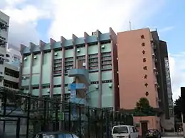
At present, there are 46 primary and 44 secondary schools in Sha Tin and Ma On Shan.[11] Tertiary institutions include Hong Kong Baptist University (Shek Mun Campus), the Chinese University of Hong Kong, the Hang Seng University of Hong Kong, the Hong Kong Institute of Vocational Education - Sha Tin (IVE-ST) and the Hong Kong Sports Institute.
- Hong Kong Baptist University (Shek Mun Campus)
- The Chinese University of Hong Kong
- St. Rose of Lima's College
- Baptist Lui Ming Choi Secondary School
- Buddhist Wong Wan Tin College
- Lutheran Theological Seminary
- Ng Yuk Secondary School
- Sha Tin College
- Sha Tin Junior School
- Sha Tin Government Secondary School
- Sha Tin Methodist College
- Shatin Tsung Tsin Secondary School
- Stewards Pooi Kei College
- Sheng Kung Hui Tsang Shiu Tim Secondary School
- Jockey Club Ti-I College
- Pui Ying College
- Christ College
- Carmel Alison Lam Primary School
- Lok Sin Tong Young ko hsiao Lin Secondary School
- Hong Kong and Kowloon CCPA Ma Chung Sum Secondary School
- Kiangsu-Chekiang College (Shatin)
- Pentecostal Lam Hon Kwong School
- Lam Tai Fai College
- Hong Kong Baptist University Affiliated School Wong Kam Fai Secondary And Primary School
Culture, sports and recreational facilities
There are numerous cultural, recreational and sport facilities in Sha Tin including the Town Hall, swimming pools, football pitches, indoor recreation centres and various track and field facilities for the use of Sha Tin residents.
The 8-hectare Sha Tin Park was opened to public in 1988. Apart from its horticultural gardens and impressive water features, it also includes a large open plaza and a bandstand. The Ma On Shan Park, which is adjacent to Ma On Shan Swimming Pool, occupies 5.5 hectare of land.
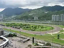
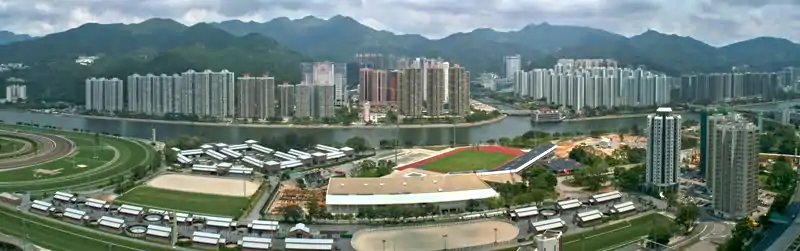
The Sha Tin Racecourse, occupying approximately 70 hectares, rests on reclaimed flatland. At the centre of the racecourse is the Penfold Garden which opens to the public on non-racing days.
Located in Tai Wai, the Hong Kong Heritage Museum was opened at the end of 2000. Apart from introducing the art, culture and history of the New Territories, the museum also exhibits a variety of cultural artifacts for public appreciation. The museum, which can accommodate 6,000 visitors, is the largest in the territory.
.JPG.webp)
Cycling has been a distinctive feature in Sha Tin and is very popular among both local people and visitors. The first cycle track in Sha Tin was opened to public in 1981, running along Tolo Highway to Tai Po, and this remains the territory's most popular cycling venue, drawing many occasional riders at the weekends, as well as dedicated cyclists. To tie in with the development of Ma On Shan, the cycle track was extended to Ma On Shan.
Hiking is also a wonderful activity you could do in your leisure time living in Sha Tin. There are several starting points including Hin Tin Village, Sha Tin Tau Village and Hung Mui Kuk Barbecue Area leading to the track of Lion Rock Mountain hiking route. It would take you 1 hour to 4 hours to complete the track depends on the starting point and ending point you choose.
Local delicacies
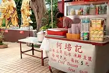
Sha Tin is famous for certain local variants of Cantonese food such as ShanSui Tofu (Chinese: 山水豆腐; lit. 'mountain-water beancurd'), barbecued pigeon and chicken congee. The cooked food stalls in Wo Che Estate and Fo Tan are hotspots for food.
Transportation
There are numerous transportation links both within the Sha Tin District and connecting it to other places in Hong Kong.
Roads
The road network in Sha Tin is well developed to provide efficient cross-town and local access traffic. Connection between Sha Tin and Kowloon mainly relies on the Lion Rock Tunnel, Tate's Cairn Tunnel, Shing Mun Tunnel and Tai Po Road which makes it easy to reach from many areas of Kowloon as well as from Tsuen Wan.
- Tai Po Road spans from Sham Shui Po in Kowloon to Tai Po in the New Territories, connecting Sha Tin en route. It was once the only road connecting Kowloon and the eastern part of the New Territories.
- Opened in the 1960s, the Lion Rock Tunnel offers access to Central Kowloon.
- The Tate's Cairn Highway was completed in 1991, connecting East Kowloon (Wong Tai Sin, Diamond Hill, Choi Hung, Kowloon Bay, and Kwun Tong) and Hong Kong Island via the Eastern Harbour Crossing with the North East New Territories (Sha Tin, Tai Po and Fanling) via the Tolo Highway and through Tate's Cairn Tunnel.
- Route connects Sha Tin to Tsuen Wan via the Shing Mun Tunnels and to Hong Kong Island via the Western Harbour Crossing. The travelling time is only about 30 minutes.
- Sai Sha Road was opened in 1988, connecting Sha Tin to Sai Kung via Ma On Shan. Route T7, opened in August 2004, allows traffic to bypass Ma On Shan Town Centre when going from north of Ma On Shan to Sai Kung.
- An expressway (via Eagle's Nest Tunnel) connecting Cheung Sha Wan in Kowloon to Sha Tin was opened on 21 March 2008. It aims at distributing traffic from Sha Tin and the area to its north, to Lai Chi Kok, Kwai Chung, and the airport at Chek Lap Kok and Mong Kok. It has shortened the trip from Sha Tin to the Chek Lap Kok International Airport to around 40 minutes.
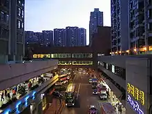
At present, there are over 110 routes of public bus serving Sha Tin.
Railway
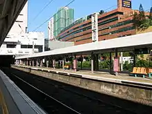
- The MTR (East Rail line) is a major means of transportation between Kowloon and Lo Wu via Sha Tin. After the electrification of the line between 1979 and 1983, the East Rail now carries over 730,000 passengers daily.
- The Ma On Shan line opened on 21 December 2004. The 11.4 km long railway has 9 stations linking Ma On Shan and Tai Wai, where it connects with the main East Rail line (terminus). The MTR Maintenance Centre is located in Tai Wai.
- Sha Tin to Central Link (Chinese: 沙田至中環線) is a railway project under construction which incorporates an extension to the Ma On Shan line to Hung Hom via Kai Tak, as well as an extension of the East Rail line to Central via a new tunnel under the harbour.
Architecture
While having been mass developed in the 1970s, Shatin's architecture maintains a degree of diversity. Most public housing estates were designed in a modern architectural style. Several shopping centres, hotels and government buildings around Shatin Central are clad in red brick.

Climate
| Climate data for Sha Tin (1985–2016) | |||||||||||||
|---|---|---|---|---|---|---|---|---|---|---|---|---|---|
| Month | Jan | Feb | Mar | Apr | May | Jun | Jul | Aug | Sep | Oct | Nov | Dec | Year |
| Record high °C (°F) | 27.6 (81.7) |
28.6 (83.5) |
31.8 (89.2) |
31.9 (89.4) |
33.8 (92.8) |
36.4 (97.5) |
37.5 (99.5) |
36.8 (98.2) |
36.5 (97.7) |
33.0 (91.4) |
31.8 (89.2) |
28.9 (84.0) |
37.5 (99.5) |
| Average high °C (°F) | 19.0 (66.2) |
19.6 (67.3) |
21.9 (71.4) |
25.5 (77.9) |
28.8 (83.8) |
30.7 (87.3) |
31.8 (89.2) |
31.8 (89.2) |
30.9 (87.6) |
28.4 (83.1) |
24.8 (76.6) |
20.9 (69.6) |
26.2 (79.2) |
| Daily mean °C (°F) | 15.5 (59.9) |
16.4 (61.5) |
18.8 (65.8) |
22.5 (72.5) |
25.9 (78.6) |
27.9 (82.2) |
28.7 (83.7) |
28.5 (83.3) |
27.6 (81.7) |
25.1 (77.2) |
21.3 (70.3) |
17.2 (63.0) |
22.9 (73.2) |
| Average low °C (°F) | 12.6 (54.7) |
13.8 (56.8) |
16.4 (61.5) |
20.1 (68.2) |
23.6 (74.5) |
25.7 (78.3) |
26.1 (79.0) |
25.9 (78.6) |
25.1 (77.2) |
22.5 (72.5) |
18.5 (65.3) |
14.0 (57.2) |
20.4 (68.7) |
| Record low °C (°F) | 2.9 (37.2) |
4.0 (39.2) |
4.4 (39.9) |
10.2 (50.4) |
15.3 (59.5) |
19.9 (67.8) |
21.3 (70.3) |
22.1 (71.8) |
19.9 (67.8) |
14.4 (57.9) |
6.3 (43.3) |
4.8 (40.6) |
2.9 (37.2) |
| Average precipitation mm (inches) | 31.2 (1.23) |
36.6 (1.44) |
67.1 (2.64) |
151.9 (5.98) |
302.7 (11.92) |
444.8 (17.51) |
412.2 (16.23) |
418.8 (16.49) |
273.2 (10.76) |
98.5 (3.88) |
46.0 (1.81) |
36.2 (1.43) |
2,319.2 (91.31) |
| Average relative humidity (%) | 73 | 77 | 80 | 81 | 82 | 82 | 80 | 81 | 77 | 72 | 71 | 69 | 77 |
| Source: Hong Kong Observatory[12] | |||||||||||||
References
- "Shatin showplace taking shape" (PDF). Hong Kong Standard. 21 February 1983. Retrieved 5 October 2014.
- "近百名人到上水示威不滿內地水貨客" Archived 5 November 2014 at the Wayback Machine. now.com. 15 September 2012. Retrieved 29 October 2014.
- Ma, Mary (10 February 2015). "Parallel lines of concern need fixing". The Standard
- Jennifer, Ngo "Milk powder supplies still not meeting needs" Archived 17 December 2014 at the Wayback Machine. South China Morning Post. 24 January 2014. Retrieved 29 October 2014
- Luk, Eddie (21 September 2012). "Seeing red (white and blue)" Archived 2015-03-11 at Archive.today. The Standard
- Wong, Hilary; Cheng, Kevin (9 March 2015). "Targeting mainlanders ... young and old" Archived 2015-04-02 at the Wayback Machine. The Standard
- "Hong Kong Protests Against Day Trippers as China Eyes Action". Bloomberg L.P. Archived from the original on 21 April 2017. Retrieved 11 March 2017.
- "thaiworldview: Sha Tin". Archived from the original on 25 March 2012. Retrieved 20 March 2012.
- "Sai Lim Temple". Archived from the original on 13 November 2020. Retrieved 12 November 2020.
- "International Fellowship North website". Archived from the original on 17 May 2014. Retrieved 20 October 2013.
- "School List". Hong Kong Education Bureau. 2008. Archived from the original on 5 March 2012.
- "Monthly Means of Meteorological Elements for Sha Tin, 1985-2016". Hong Kong Observatory. Archived from the original on 17 March 2018. Retrieved 8 February 2017.
Further reading
- Hase, P. H. (2020). "Chapter 3. Traditional Sha Tin". Settlement, Life, and Politics - Understanding the Traditional New Territories. Royal Asiatic Society Hong Kong studies series. City University of Hong Kong Press. pp. 215–320. ISBN 9789629374419.
External links
| Wikimedia Commons has media related to Sha Tin. |