Shellpot Creek
Shellpot Creek is a tributary of the Delaware River in northeast New Castle County, Delaware.[5] The stream rises between Grubb Road and Shipley Road, south of Naaman's Road at 39°49′19″N 75°31′55″W in Brandywine Hundred and flows southeast for about six miles before discharging into the Delaware River at 39°44′05″N 75°30′16″W near Edgemoor.[6][7] Prior to 1938, the stream drained into the Brandywine Creek, but was subsequently redirected to the Delaware River.[8]
| Shellpot Creek Tributary to Delaware River | |
|---|---|
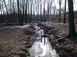 Shellpot Creek at Tarleton Park | |
 Location of Shellpot Creek mouth  Shellpot Creek (the United States) | |
| Location | |
| Country | United States |
| State | Delaware |
| County | New Castle |
| City | Bellefonte, Delaware |
| Physical characteristics | |
| Source | divide between Shellpot Creek and Brandywine Creek |
| • location | Between Grubb and Shipley Road in Brandywine Hundred. |
| • coordinates | 39°49′19″N 75°31′55″W[1] |
| • elevation | 340 ft (100 m)[2] |
| Mouth | Delaware River |
• location | Bellefonte, Delaware |
• coordinates | 39°44′05″N 75°30′16″W[1] |
• elevation | 0 ft (0 m)[2] |
| Length | 8.7 miles[3] |
| Basin size | 9.32 square miles (24.1 km2)[4] |
| Basin features | |
| Progression | southeast |
| River system | Delaware River |
| Tributaries | |
| • left | unnamed tributaries |
| • right | Turkey Run Matson Run |
The watershed has a drainage area of nearly 15 square miles, and is the most suburbanized drainage area in the state-designated "Piedmont Basin"[7] (which consists of the watersheds of the Christina River, Brandywine Creek, Red Clay Creek, White Clay Creek, Naamans Creek, and Shellpot Creek).[9] New Castle County, the Calpine Edge Moor Power Plant, the former Chemours Edge Moor plant, Amtrak, and the City of Wilmington all discharge storm-water into Shellpot Creek.[10] During Tropical Storm Allison (1989), the creek flooded to record levels, with the flow rising from 1,300 gallons per minute to 3.6 millions of gallons per minute (or more than 8,000 cubic feet per second).[8][11]
The name is likely derived from the Swedish Sköllpadde Fallet (meaning "Turtle Falls"),[12] and has been historically known as "Schillpades", "Skilpot", and "Shilpot".
See also
References
- "GNIS Detail - Shellpot Creek". geonames.usgs.gov. Retrieved 19 May 2019.
- "Shellpot Creek Topo Map, New Castle County DE (Wilmington South Area)". TopoZone. Locality, LLC. Retrieved 3 August 2019.
- "Total Maximum Daily Loads (TMDLs) Analysis for Shellpot Creek, Delaware" (PDF). Delaware Division of Water Resources. Retrieved 19 May 2019.
- "Shellpot Creek Watershed Report". Waters Geoviewer. US EPA. Retrieved 3 August 2019.
- "Shellpot Creek Watershed" (PDF). DNREC.
- U.S. Geological Survey Geographic Names Information System: Shellpot Creek
- "Shellpot Creek - Delaware Watersheds". Delaware Watersheds. Delaware Department of Natural Resources and Environmental Control and University of Delaware, Water Resources Agency. Archived from the original on 2013-09-04.
- Bagwell, Anne Marina (2007). A Synoptically Guided Approach to Determining Suburbanization's Impacts on the Hydrology of the Red and White Clay Creeks, Pennsylvania and Delaware. University of Delaware, Department of Geography. p. 71. ISBN 0549387145.
- "The Piedmont Basin". Delaware Watersheds. Delaware Department of Natural Resources and Environmental Control and University of Delaware, Water Resources Agency. Archived from the original on 2013-09-04.
- "Decision Rationale Total Maximum Daily Loads for Shellpot Creek, New Castle County, Delaware" (PDF). EPA.
- "USGS 01477800 SHELLPOT CREEK AT WILMINGTON, DE".
- Federal Writers' Project (1938). Delaware: A Guide to the First State. US History Publishers. p. 326.