Shenley River
The Shenley River (in French: rivière Shenley) is a tributary of the west bank of the Chaudière River at Saint-Martin which flows northward to empty on the shore south of the St. Lawrence River. It flows in the municipalities of Saint-Honoré-de-Shenley and Saint-Martin, in the Beauce-Sartigan Regional County Municipality, in the administrative region of Chaudière-Appalaches, in Quebec, in Canada.
| Shenley River | |
|---|---|
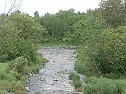 Shenley River towards the point of confluence with the Chaudière River. | |
 | |
| Native name | Rivière Shenley (French) |
| Location | |
| Country | Canada |
| Province | Quebec |
| Region | Chaudière-Appalaches |
| MRC | Beauce-Sartigan Regional County Municipality |
| Physical characteristics | |
| Source | Agricultural and forest streams |
| • location | Saint-Honoré-de-Shenley |
| • coordinates | 45.985585°N 70.794492°W |
| • elevation | 438 metres (1,437 ft) |
| Mouth | Chaudière River |
• location | Saint-Martin |
• coordinates | 45.94556°N 70.65527°W |
• elevation | 226 metres (741 ft) |
| Length | 12.3 kilometres (7.6 mi) |
| Basin features | |
| Progression | Chaudière River, St. Lawrence River |
| River system | St. Lawrence River |
| Tributaries | |
| • left | (upstream) |
| • right | (upstream) |
Geography
The main neighboring watersheds of the Shenley River are:
- north side: Roy brook, Dutil brook, Pozer River, Chaudière River
- east side: Chaudière River
- south side: rivière de la Grande Coudée, Petit Portage River;
- west side: Toinon River, Le Petit Shenley, Bras Saint-Victor.
The Shenley River originates from several tributaries that drain the area south of Vaseux Lake, northeast of the village of Saint-Honoré-de-Shenley. Its source is located 3.6 kilometres (2.2 mi) northeast of the center of the village of Saint-Honoré-de-Shenley 2.5 kilometres (1.6 mi) north of route 269 and south of the center of the village of Saint-Benoît-Labre.
From its source, the Shenley River flows over 12.3 kilometres (7.6 mi) divided into the following segments:
- 0.3 kilometres (0.19 mi) towards the south-east, up to the 4th Rang Nord that it intersects at 2.4 kilometres (1.5 mi) north of route 269;
- 3.5 kilometres (2.2 mi) south-east, to an old country road, which it cuts at 0.9 kilometres (0.56 mi) south of route 269;
- 3.9 kilometres (2.4 mi) southeasterly, to the 2nd Rang de Shenley North;
- 4.6 kilometres (2.9 mi) southeasterly, crossing route 269 and 4th rue West, to its confluence.[1]
The Shenley River empties on the west bank of the Chaudière River at Saint-Martin. Its confluence is 1.4 kilometres (0.87 mi) upstream from the bridge in the village of Saint-Martin and downstream from the village of Saint-Gédéon-de-Beauce.
Toponymy
The toponym "Shenley River" was formalized on December 5, 1968 at the Commission de toponymie du Québec.[2]