Sierra Nevada de Lagunas Bravas
Sierra Nevada, also known as Sierra Nevada de Lagunas Bravas, is a major ignimbrite-lava dome complex[1] which lies in both Chile and Argentina in one of the most remote parts of the Central Andes. Activity in the complex started in Argentina and formed two stratovolcanoes. Later, 12 or more vents formed, some with craters up to 400 metres (1,300 ft) wide. Lava flows up to 7 kilometres (4.3 mi) long with flow ridges are also found. It covers a total area of 225 km².[2] Radiometric dating has yielded ages of 1.7 ± 0.4 to 0.431 ± 0.012 million years ago.[3] Together with Cerro el Condor and Peinado it forms the Culampaja line, a line of volcanoes that reaches Cerro Blanco.[4] Strong seismic attenuation is observed beneath Sierra Nevada.[1] Hydrothermally altered rocks in Sierra Nevada may be the source of sulfate and As in the Juncalito and Negro rivers.[5]
| Sierra Nevada de Lagunas Bravas | |
|---|---|
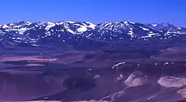 The complex stratovolcano of Sierra Nevada from the south | |
| Highest point | |
| Elevation | 6,127 m (20,102 ft) |
| Coordinates | 26°29′31″S 68°33′34″W |
| Geography | |
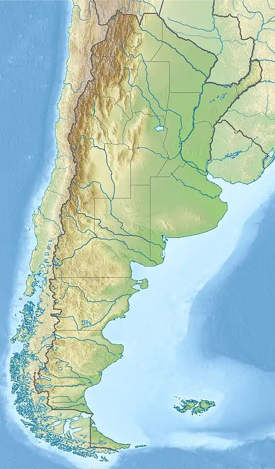 Sierra Nevada de Lagunas Bravas Argentina | |
| Location | Argentina / Chile |
| Parent range | Andes |
| Geology | |
| Age of rock | Holocene |
| Mountain type | Stratovolcano |
| Last eruption | Unknown |
| Climbing | |
| First ascent | 6137 metre summit - February 2013 - Eduardo Olivier - Chile / 6127 metre summit - December 12, 2000 - Robert Ayers, Tony Brake, Paul Doherty, Paul Morgan - United States |
Sierra Nevada is a remote peak on the Chile-Argentina border. As such it was probably the second last 6000m+ peak in the Andes to be climbed,[6] the first recorded ascent being in December 2000.[7] The snowline in the area lies at 5,800 metres (19,000 ft) altitude at Cumbre del Laudo.[8]
Although the Chilean/Argentinean border in this region was supposed to run along the highest summits, the border Summit is not the highest one. The highest one is located 2.45km west (-26.490800° -68.559100°) and is probably 6137m (TandemX 6172m). This summit was first reached by Eduardo Olivier in 2013.[9]
References
- Kay, S. M.; Mpodozis, C.; Gardeweg, M. (7 August 2013). "Magma sources and tectonic setting of Central Andean andesites (25.5-28 S) related to crustal thickening, forearc subduction erosion and delamination". Geological Society, London, Special Publications. 385 (1): 325. doi:10.1144/SP385.11.
- "Sierra Nevada". Global Volcanism Program. Smithsonian Institution.
- GROSSE, Pablo; GUZMÁN, Silvina; PETRINOVIC, Ivan (2017). "VOLCANES COMPUESTOS CENOZOICOS DEL NOROESTE ARGENTINO" (PDF). ResearchGate (in Spanish). Tucuman: 20th Chilean Geological Congress. p. 508. Retrieved 20 January 2018.
- Mulcahy, Patrick; Chen, Chen; Kay, Suzanne M.; Brown, Larry D.; Isacks, Bryan L.; Sandvol, Eric; Heit, Benjamin; Yuan, Xiaohui; Coira, Beatriz L. (August 2014). "Central Andean mantle and crustal seismicity beneath the Southern Puna plateau and the northern margin of the Chilean-Pampean flat slab". Tectonics. 33 (8): 1638. doi:10.1002/2013TC003393. hdl:11336/35932.
- Aguirre, L.; Clavero, J. (2000). "Antecedentes fisicoquimicos preliminares de cuerpos de agua superficial del Altiplano de la III region de Atacama, Chile" (PDF). biblioserver.sernageomin.cl (in Spanish). 9th Chilean Geological Congress. p. 357. Retrieved 5 November 2016.
- Biggar, John (2005). The Andes: A Guide for Climbers (3rd ed.). Andes Publishing (Scotland). pp. 304 pp. ISBN 0-9536087-2-7.
- American Alpine Club Journal. 2002. p. 328.
- Haselton, Kirk; Hilley, George; Strecker, Manfred R. (March 2002). "Average Pleistocene Climatic Patterns in the Southern Central Andes: Controls on Mountain Glaciation and Paleoclimate Implications" (PDF). The Journal of Geology. 110 (2): 215. doi:10.1086/338414. Retrieved 24 February 2016.
- "Andean Mountains - All above 5000m". Andes Specialists (in Portuguese). Retrieved 2020-04-07.
Sources
- "Sierra Nevada". Global Volcanism Program. Smithsonian Institution.
- González-Ferrán, Oscar (1995). Volcanes de Chile. Santiago, Chile: Instituto Geográfico Militar. pp. 215–220. ISBN 956-202-054-1. (in Spanish; also includes volcanoes of Argentina, Bolivia, and Peru)
