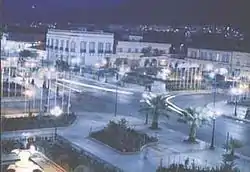
Sig, Algeria
Sig (Arabic: سيق Sīq; called Saint-Denis-de-Sig[1] under French rule; Latin: Tasacora) is a town in northwestern Algeria. Formerly located in Oran Province and now located in Mascara Province, north-western Algeria. Its population was 61,373 in 2008.[2]
Sig | |
|---|---|
Town | |
 | |
 Sig | |
| Coordinates: 35°31′40″N 0°11′10″W | |
| Country | |
| Provinces | Oran |
| District | Sig |
| Population (Census 2008) | |
| • Total | 70,499 |
The town's public garden is on the bank of the Sig River just down stream the confluence of the le-Mebtoûh and the Matarah. Sig is surrounded by fertile land irrigated by the Barrages des Cheurfas (dams) 25 kilometres (16 mi) upstream with the overflow stored in the Petit Barrage (little dams) 3.2 kilometres (2.0 mi) upstream from the town. The local land supports the growing of olives, cotton, flax, grains, tobacco, and wine, much of which is processed locally and exported. The other local industry is mineral mining, primarily for diatomite.[2]
Sig is located about 29 kilometres (18 mi) south the Gulf of Arzew, separated by the Sig plains and north-west of Mount Touakas (349 metres (1,145 ft) high).[2] Sig is about 44 kilometres (27 mi) east of Oran and 450 kilometres (280 mi) from Algiers. The temperatures usually rise from May to the end of August.
Notable people
- Rachid Taha (1958–2018), musician (birthplace)
See also
Notes
- Toulotte 1894, p. 155.
- EB staff 2015.
References
- EB staff (2015), "Sig - Algeria", Encyclopædia Britannica, retrieved 26 April 2015
- Toulotte, Anatole (1894), Géographie de l'Afrique chrétienne, Oberthur, p. 155, retrieved 5 November 2012
.svg.png.webp)
