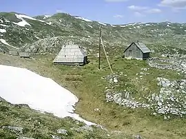
Sinjajevina
Sinjajevina (Serbian Cyrillic: Сињајевина, pronounced [sǐɲajɛʋina] also known as Sinjavina, [sǐɲaːʋina]) is a mountain in northern Montenegro. The highest point of Sinjajevina is Torna, which is 2,277 m (7,470 ft) high.
| Sinjajevina | |
|---|---|
 Sinjajevina | |
| Highest point | |
| Elevation | 2,277 m (7,470 ft) |
| Coordinates | 42°57′30″N 19°20′00″E |
| Geography | |
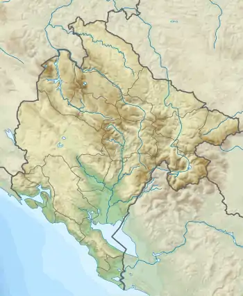 Sinjajevina Location in Montenegro | |
| Location | Montenegro |
Features
Sinjajevina Mountain stretches from SE to NW, between town of Kolašin and village of Njegovuđa, near Žabljak. The massif is 40 km long and 15 km wide.
Geologically, its composition is cretaceous limestone. The high mountain plain averages 1,600 m (5,249 ft) in height, with only a few peaks of higher elevation.
Peaks
The highest peaks of Mt Sinjajevina are:
- Jablanov vrh 2,277 m (7,470 ft)
- Torna 2,203 m (7,228 ft)
- Gradiste 2,214 m (7,264 ft)
- Sto 2,172 m (7,126 ft)
- Savina greda 2,101 m (6,893 ft)
- Veliki Pecarac 2,042 m (6,699 ft)
- Veliki Starac 2,022 m (6,634 ft)
- Babin vrh 2,013 m (6,604 ft)
- Sto 1,959 m (6,427 ft)
- Korman 1,923 m (6,309 ft)
- Mali Starac 1,921 m (6,302 ft)
Lakes
Mt Sinjajevina is home to two lakes, both in a process of natural extinction:
- Zabojsko Lake
- Zminičko Lake
This article is issued from Wikipedia. The text is licensed under Creative Commons - Attribution - Sharealike. Additional terms may apply for the media files.
