Six Mile, South Carolina
Six Mile is a town in Pickens County, South Carolina, United States. The 2010 census showed a population of 675, representing a 21% increase since 2000.
Six Mile, South Carolina | |
|---|---|
 Top, left to right: Six Mile Town Hall, Liberty Highway, Six Mile Baptist Church, view of nearby mountain from Main Street | |
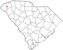 Location of Six Mile, South Carolina | |
| Coordinates: 34°48′7″N 82°49′4″W | |
| Country | United States |
| State | South Carolina |
| County | Pickens |
| Area | |
| • Total | 2.05 sq mi (5.31 km2) |
| • Land | 2.04 sq mi (5.28 km2) |
| • Water | 0.01 sq mi (0.03 km2) |
| Elevation | 1,024 ft (312 m) |
| Population (2010) | |
| • Total | 675 |
| • Estimate (2019)[2] | 672 |
| • Density | 329.74/sq mi (127.32/km2) |
| Time zone | UTC-5 (Eastern (EST)) |
| • Summer (DST) | UTC-4 (EDT) |
| ZIP code | 29682 |
| Area code(s) | 864 |
| FIPS code | 45-66760[3] |
| GNIS feature ID | 1226654[4] |
| Website | www.sixmilesc.org |
Six Mile was named "Six Mile" because it was located six miles from Fort Prince George. Many other landmarks in this area were named by their distance from Fort Prince George such as 12 Mile River and 18 Mile Creek.[5]
Geography
Six Mile is located at 34°48′7″N 82°49′4″W (34.801983, −82.817857).[6]
According to the United States Census Bureau, the town has a total area of 1.8 square miles (4.7 km2), of which 1.8 square miles (4.7 km2) is land and 0.55% is water.
Climate
The climate is mild and temperate with rainfall evenly distributed throughout the year. Winters are moderate with an average monthly temperature of 43. Snowfall occurs each winter, but significant amounts come only once every two or three years. Spring is a period of transition with March the month for heavy rains. As the showers decrease, a secondary dry period occurs late in April and early May. Steady rains typical of winter are likely in early spring. The average date of the last spring freeze falls around the end of March, which gives the area a growing season of approximately 180–200 days. Summers are warm and long with the average temperatures hovering around 79. Temperatures reach 90 on an average of 48 days a year. Six Mile's warm and pleasant autumn is the driest season of the year with the first frost usually occurring the first week of November.
Demographics
| Historical population | |||
|---|---|---|---|
| Census | Pop. | %± | |
| 1920 | 134 | — | |
| 1930 | 150 | 11.9% | |
| 1940 | 152 | 1.3% | |
| 1950 | 157 | 3.3% | |
| 1960 | 218 | 38.9% | |
| 1970 | 361 | 65.6% | |
| 1980 | 470 | 30.2% | |
| 1990 | 562 | 19.6% | |
| 2000 | 553 | −1.6% | |
| 2010 | 675 | 22.1% | |
| 2019 (est.) | 672 | [2] | −0.4% |
| U.S. Decennial Census[7] | |||
The 2010 census showed a population of 675; this is a 21% growth increase since the 2000 census.
There were 200 households, out of which 37.5% had children under the age of 18 living with them, 67.0% were married couples living together, 7.0% had a female householder with no husband present, and 23.0% were non-families. 20.0% of all households were made up of individuals, and 8.0% had someone living alone who was 65 years of age or older. The average household size was 2.60 and the average family size was 3.02.
In the town, the population was spread out, with 24.1% under the age of 18, 8.1% from 18 to 24, 26.9% from 25 to 44, 25.5% from 45 to 64, and 15.4% who were 65 years of age or older. The median age was 40 years. For every 100 females, there were 96.8 males. For every 100 females age 18 and over, there were 97.2 males.
The median income for a household in the town in 2012 was $53,143, and the median income for a family was $57,667. Males had a median income of $42,792 versus $27,000 for females. The per capita income for the town was $25,260. About 3.5% of families and 4.5% of the population were below the poverty line, including 12.3% of those under age 18 and none of those age 65 or over.
References
- "2019 U.S. Gazetteer Files". United States Census Bureau. Retrieved July 29, 2020.
- "Population and Housing Unit Estimates". United States Census Bureau. May 24, 2020. Retrieved May 27, 2020.
- "U.S. Census website". United States Census Bureau. Retrieved 2008-01-31.
- "US Board on Geographic Names". United States Geological Survey. 2007-10-25. Retrieved 2008-01-31.
- "History & Climate". The Town of Six Mile. Retrieved December 8, 2012.
- "US Gazetteer files: 2010, 2000, and 1990". United States Census Bureau. 2011-02-12. Retrieved 2011-04-23.
- "Census of Population and Housing". Census.gov. Retrieved June 4, 2015.
External links
Municipalities and communities of Pickens County, South Carolina, United States | ||
|---|---|---|
| Cities |  Map of South Carolina highlighting Pickens County | |
| Towns | ||
| CDP | ||
| Unincorporated communities | ||
| Footnotes | ‡This populated place also has portions in an adjacent county or counties | |
| ||