Skradin
Skradin (Italian: Scardona; Ancient Greek: Σκάρδων[2]) is a small town in the Šibenik-Knin County of Croatia, with a population of 3,825 (2011 census). It is located near the Krka river and at the entrance to the Krka National Park, 17 km (11 mi) from Šibenik and 100 km (62 mi) from Split. The main attraction of the park, Slapovi Krke, is a series of waterfalls, the biggest of which, Skradinski buk, was named after Skradin.
Skradin | |
|---|---|
| Grad Skradin Town of Skradin | |
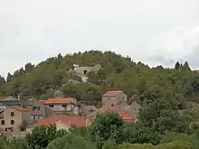
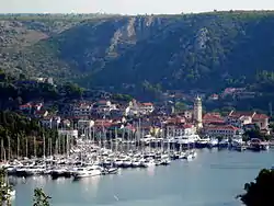 View of Skradin | |
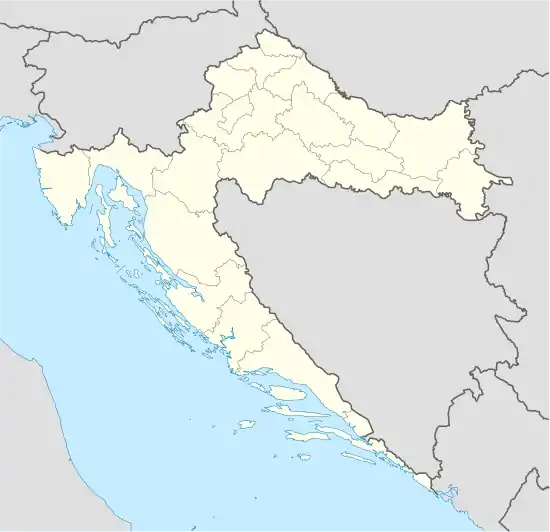 Skradin Location of Skradin within Croatia | |
| Coordinates: 43°49′N 15°55′E | |
| Country | |
| County | |
| Government | |
| • Mayor | Antonijo Brajković (HDZ) |
| Population (2011)[1] | |
| • Total | 3,825 |
| Time zone | UTC+1 (CET) |
| • Summer (DST) | UTC+2 (CEST) |
| Postal code | 22222 |
| Area code(s) | 022 |
| Website | Skradin.hr |
History
It was a Liburnian city, named Scardon (Ancient Greek: Σκάρδων).[2] Later it became a Roman town (Scardona in Latin) , as the administrative and military centre of the region. It was destroyed during the Migration Period, and had by the 9th century been settled by Slavs.
During the 10th century, it was one of the fortified towns in Croatia, as the centre of the Skradin županija.
Skradin under Šubić rule
In the late 13th and early 14th centuries, Skradin flourished as the capital of the Šubić bans, Paul I and Mladen II. The Šubić's built the Turina fortress on the hill overlooking the Skradin harbor.[3] They elevated the settlement below the fortress to a free city, at which point it also became a commune, and was granted its own statute and administration.[4][5][6] They further enriched the city by constructing several richly-endowed monasteries which housed the Dominicans, Franciscans and other Christian orders.[7]
Decline and Ottoman conquest
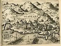
Between 1522 and 1684 it was ruled by the Ottoman Empire, then again up to 1794 by the Republic of Venice.
In October 1683, the population of Venetian Dalmatia, principally Uskoks of Ravni kotari, took arms and together with the rayah (lower class) of the Ottoman frontier regions rose up, taking Skradin, Karin, Vrana, Benkovac and Obrovac.[8]
Later, it was occupied by Napoleon as part of the French Empire, then Austria-Hungary.
In time it lost its importance as the centre of the region, which shifted to Šibenik, and so it stagnated - the Diocese of Skradin was abandoned in 1828.[9]
Notable people
References
- "Population by Age and Sex, by Settlements, 2011 Census: Skradin". Census of Population, Households and Dwellings 2011. Zagreb: Croatian Bureau of Statistics. December 2012.
- Strabo, Geography, §7.5.4
- https://www.slobodnadalmacija.hr/dalmacija/sibenik/clanak/id/108953/turina-i-dalje-u-mraku--grad-spomenik-gubi-identitet
- https://repozitorij.hrstud.unizg.hr/islandora/object/hrstud:1190
- https://hrcak.srce.hr/index.php?show=clanak&id_clanak_jezik=236476
- https://hrcak.srce.hr/index.php?show=clanak&id_clanak_jezik=307648
- http://www.enciklopedija.hr/Natuknica.aspx?ID=56495
- Radovan Samardžić (1990). Seobe srpskog naroda od XIV do XX veka: zbornik radova posvećen tristagodišnjici velike seobe Srba. Zavod za udžbenike i nastavna sredstva.
Становништво Млетачке Далмације, на првом месту Котарски ускоци, још у октобру 1683. дигло се на оружје заједно с ра- јом у пограничним крајевима Турске. Устаници су "сами заузели Скрадин, Карин, Врану, Бенковац и Обровац
- Naklada Naprijed, The Croatian Adriatic Tourist Guide, pg. 209, Zagreb (1999), ISBN 953-178-097-8
