Sligo Creek Trail
Sligo Creek Trail is a paved hiker-biker trail running along Sligo Creek in the suburbs of Washington, D.C. Most of the trail passes through tree-filled parkland. The trail and surrounding park is a popular place for locals to jog, walk, bicycle, roller-skate, and take their children to the playground. Many local families enjoy picnicking at one of the 15 picnic areas along the trail.
| Sligo Creek Trail | |
|---|---|
 Sligo Creek Trail, Silver Spring, Maryland. | |
| Length | 10.2 mi (16.4 km) |
| Location | Sligo Creek, Montgomery County, Maryland |
| Trailheads | Carole Highlands, Maryland Wheaton, Maryland |
| Use | Walking, jogging, biking |
| Hiking details | |
| Trail difficulty | Easy, level, ADA accessible |
| Season | Year-round |
| Months | Year-round |
| Surface | Asphalt |
Where's the trail?
Heading upstream from southeast (closest to DC) to northwest (farthest from DC):
The Prince George's County section is about 1.6 miles (2.6 km) long. It begins at the intersection with the Northwest Branch Trail of the Anacostia Tributary Trail System, crosses Riggs Road, passes behind the Parklawn Community Recreational Center, crosses East-West Highway and ends in Carole Highlands.
Junction list
The Montgomery County section is about 7.3 miles (11.7 km) long. It begins in Carole Highlands and ends inside the Wheaton Regional Recreation Park (WRRP).
Between Carole Highlands and WRRP, Sligo Creek Trail crosses (in this order):
- New Hampshire Avenue
- (passes underneath Carroll Avenue)
- Maple Avenue
- Piney Branch Road
- Wayne Avenue
- Colesville Road
- (passes underneath the Capital Beltway)
- Forest Glen Road
- Dennis Avenue
- University Boulevard
- (gets across Arcola Avenue via a trail connector)
- Different parts of the Sligo Creek Trail
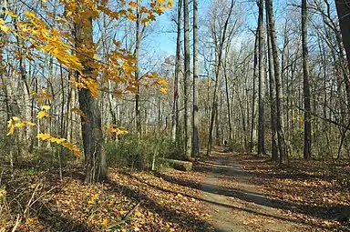 In the Fall, Forest Glen
 Sligo Creek Trail in Silver Spring
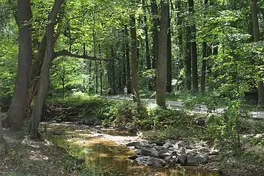 Sligo Creek with the Sligo Creek Trail in the background.
External links
- Detailed trail map; covers only Carole Highlands to WRRP (Montgomery County)
- Less detailed map that covers the Prince George's County portion of the trail plus other connecting trails in the Anacostia system
- Mileage between landmarks along the entire Sligo Creek Trail, both counties
- Info on many DC area bike trails, including Sligo Creek Trail
- Friends of Sligo Creek