Soła
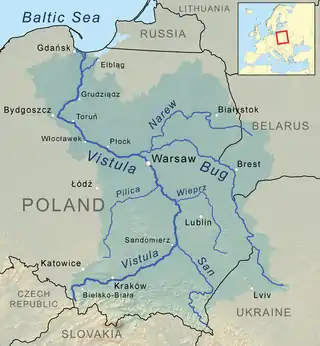
The Soła (Polish: [ˈsɔwa]) is a river in southern Poland, a right tributary of the Vistula.
| Soła | |
|---|---|
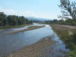 Soła near Wieprz | |
| Location | |
| Country | Poland |
| Physical characteristics | |
| Source | |
| • location | Rajcza |
| • coordinates | 49°30′25″N 19°06′27″E |
| • elevation | 776 m (2,546 ft) |
| Mouth | |
• location | Broszkowice north of Oświęcim |
• coordinates | 50°3′12″N 19°14′47″E |
| Length | 88.9 km (55.2 mi) |
| Basin size | 1,375 km2 (531 sq mi) |
| Discharge | |
| • average | 18.8 m3 (660 cu ft) |
| Basin features | |
| Progression | Vistula→ Baltic Sea |
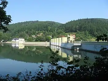
Soła originates in the Western Beskids mountain range near the border with Slovakia. It is made up of the confluence of several small creeks at the village of Rajcza. It runs downhill northeastwards through Żywiec Basin to the towns of Żywiec and Kęty, forming the border between the Silesian and the Żywiec Beskids. After 89 km (55 mi), the Soła empties into the Vistula River after having passed the town of Oświęcim.[1]
The river flows within metres of the Auschwitz concentration camp. The Auschwitz-Birkenau State Museum informs that the human ashes and ground bones of those murdered there were often dumped into the river.[2]
Soła flows through or near the following settlements: Rajcza, Milówka, Cisiec, Węgierska Górka, Cięcina, Radziechowy, Wieprz, Żywiec, Tresna, Czernichów, Międzybrodzie Żywieckie, Międzybrodzie Bialskie, Porąbka, Czaniec, Kobiernice, Kęty, Nowa Wieś, Hecznarowice, Bielany, Łęki, and Oświęcim.
Notes and references
- Oficjalny serwis gminy Rajcza – rajcza.com Archived 2010-11-26 at the Wayback Machine (in Polish)
- Dr. Franciszek Piper, "The extermination procedure in the gas chambers", Auschwitz-Birkenau State Museum (Państwowe Muzeum Auschwitz-Birkenau w Oświęcimiu), 1999-2010
Tributaries of the Vistula River | ||
|---|---|---|
| Forming rivers |
|  |
| Main tributaries of the left bank | ||
| Main tributaries of the right bank |
| |
| Distributary | ||
