Sobat River
The Sobat River is a river of the Greater Upper Nile region in northeastern South Sudan, Africa. It is the most southerly of the great eastern tributaries of the White Nile, before the confluence with the Blue Nile.
| Sobat River | |
|---|---|
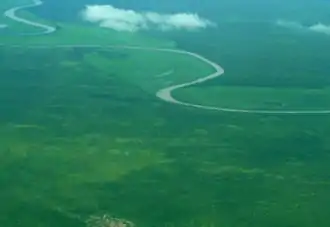 Sobat River from air | |
| Location | |
| Country | South Sudan |
| State | Upper Nile (state) |
| Physical characteristics | |
| Source | Pibor River and Baro River confluence |
| • location | Jonglei, South Sudan |
| • coordinates | 8°26′10″N 33°13′7″E |
| Mouth | White Nile |
• location | Upper Nile (state), South Sudan |
• coordinates | 9°22′2″N 31°32′57″E |
| Length | 354 km (220 mi)[1] |
| Basin size | 225,000 km2 (87,000 sq mi) |
| Discharge | |
| • location | Hillet Doleib |
| • average | 412 m3/s (14,500 cu ft/s) |
| • minimum | 99 m3/s (3,500 cu ft/s) |
| • maximum | 680 m3/s (24,000 cu ft/s) |
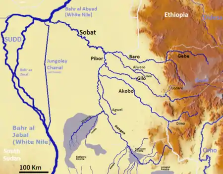
Sobat River basin
Geography
The Sobat River is formed by the confluence of the west-flowing Baro River and the north-flowing Pibor River, on the border with Ethiopia. The river enters the White Nile at Doleib Hill, near the city of Malakal in Upper Nile State.
When in flood the Sobat River produces an enormous discharge carrying a white sediment, which gives the White Nile its name.[1]
See also
References
- "Sobat River". Encyclopædia Britannica Online Library Edition. Encyclopædia Britannica. Retrieved 2008-01-21. (registration required)
- Shahin, Mamdouh (2002). Hydrology and Water Resources of Africa. Springer. pp. 276, 288. ISBN 1-4020-0866-X.; online at Google Books
| Wikimedia Commons has media related to Sobat River. |
External links
This article is issued from Wikipedia. The text is licensed under Creative Commons - Attribution - Sharealike. Additional terms may apply for the media files.
