Sorgu
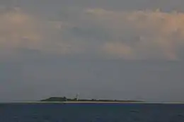
Sorgu (Swedish: Sorkholm) is a 5-hectare (12-acre)[1] uninhabited Estonian islet in the Gulf of Riga, 5 km (3.1 mi) southeast of the island of Manilaid. Administratively Sorgu belongs to the Manija village in Tõstamaa Parish, Pärnu County.
 | |
| Geography | |
|---|---|
| Location | Gulf of Riga |
| Coordinates | 58°10′42.23″N 24°11′58.63″E |
| Area | 5.07 ha (12.5 acres) |
| Coastline | 2.4 km (1.49 mi) |
| Highest elevation | 5 m (16 ft) |
| Administration | |
Estonia | |
| County | Pärnu County |
| Municipality | Tõstamaa Parish |
| Settlement | Manija village |
| Demographics | |
| Population | 0 |
The reefs of Sorgu were already mentioned on the Willem Janzoon Blaeu's 1662 Livonian map as Sorkholm. In 1904 a 16-metre (52 ft) brick lighthouse with outbuildings was built. Later in 1913 the complex was expanded to accommodate the lighthouse keeper's family. The lighthouse has been automated since the 1970s.[2][3][4]
See also
References
- "Sorgu saar" (in Estonian). EELIS – Estonian Nature Infosystem. Retrieved 24 May 2011.
- "Sorgu" (in Estonian). Eesti Saarte Kogu. Retrieved 23 May 2011.
- "Sorgu saar" (in Estonian). Tõstamaa vald. Retrieved 23 May 2011.
- "Sorgu saar" (in Estonian). Kihnu Kultuuri Instituut. Retrieved 23 May 2011.
This article is issued from Wikipedia. The text is licensed under Creative Commons - Attribution - Sharealike. Additional terms may apply for the media files.
