South Aulatsivik Island
South Aulatsivik Island is a Canadian island in northeastern part of Labrador in the province of Newfoundland and Labrador.
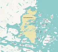
Map of South Aulatsivik Island
It is situated north of Nain at entrance of Webb's Bay, fronting the Atlantic Ocean.
The island's area measures 456 km2 making it the province's second largest island after the island of Newfoundland. Its highest point is Mount Thoresby (3,007 ft/917 m).
See also
This article is issued from Wikipedia. The text is licensed under Creative Commons - Attribution - Sharealike. Additional terms may apply for the media files.