South Dakota Highway 244
South Dakota Highway 244 (SD 244) is a short state highway located entirely within Pennington County, South Dakota which provides access to Mount Rushmore. Highway 244 runs generally east–west between its eastern terminus at US 16A near Keystone and its western terminus at US 16/US 385 south of Hill City. The entire route is part of the Peter Norbeck Scenic Byway. SD 244 does not connect to its parent route.
| ||||
|---|---|---|---|---|
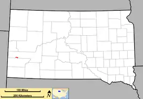 Route of SD 244 (in red) | ||||
| Route information | ||||
| Defined by SDCL §31-4-217 | ||||
| Maintained by SDDOT | ||||
| Length | 10.457 mi[1] (16.829 km) | |||
| Existed | 1975[2]–present | |||
| Major junctions | ||||
| West end | ||||
| East end | ||||
| Location | ||||
| Counties | Pennington | |||
| Highway system | ||||
| ||||

Route description
SD 244 begins in the Black Hills National Forest at an intersection with U.S. Route 16 (US 16) and US 385 south of Hill City. It heads to the east, winding through the forest where it passes Summit Peak. Near Old Baldy Mountain, the route enters the Mount Rushmore National Monument area. It curves around the park and heads back to the north. The route ends at US 16A south of Keystone.[3]
History
Highway 244 was originally part of South Dakota Highway 87. The switch to Highway 244 occurred in 1975, with the signs being concurrently posted until January 1, 1977.[2]
Major intersections
The entire route is in Pennington County.
| Location | mi[1] | km | Destinations | Notes | |
|---|---|---|---|---|---|
| | 0.000 | 0.000 | Western terminus | ||
| Mount Rushmore | 10.457 | 16.829 | Eastern terminus | ||
| 1.000 mi = 1.609 km; 1.000 km = 0.621 mi | |||||
References
- "State Highway Log" (PDF). Rapid City region: South Dakota Department of Transportation. January 2011. p. 169. Retrieved December 24, 2011.
- "Highway Division Makes Road Numbering Changes". The Sioux Falls Argus-Leader. March 20, 1975. p. 2 (32). Retrieved March 18, 2020 – via Newspapers.com.

- General Highway Map (PDF) (Map). West Half Pennington County. South Dakota Department of Transportation. 2010. Retrieved December 18, 2011.