South Dakota Highway 471
South Dakota Highway 471 (SD 471) is a 21.981-mile (35.375 km) state highway in western Fall River, South Dakota, United States, that connects Highway 71 (SD 71), southeast of Rumford, with U.S. Route 18 (US 18), in Edgemont.
| ||||
|---|---|---|---|---|
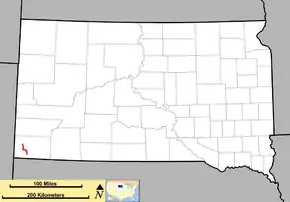 Route of SD 471 (in red) | ||||
| Route information | ||||
| Defined by SDCL §31-4-244 | ||||
| Maintained by SDDOT | ||||
| Length | 21.981 mi[1] (35.375 km) | |||
| Existed | 1976–present | |||
| Major junctions | ||||
| South end | ||||
| North end | ||||
| Location | ||||
| Counties | Fall River | |||
| Highway system | ||||
| ||||

Route description
SD 471 begins at a junction with SD 71 in the Oglala National Grassland. The highway travels northwest through the community of Rumford before turning west and passing through Provo. Here, SD 471 veers north and enters the city of Edgemont as 3rd Street before turning into 2nd Avenue. The designation continues west onto A Street, passing through Edgemont[2] before briefly turning north on 6th Avenue to terminate at US 18.[3][1]
Legal description
The legal description of SD 471 has been codified by the South Dakota Legislature: 31-4-244. State Highway 471 from State Highway 71 to U.S. Highway 18. The state trunk highway system includes the following in Fall River County: From a point on State Highway 71 north of Ardmore near the southeast corner of section eight, township eleven south, range four east, thence northwest via Edgemont to a point on U.S. Highway 18 in Edgemont in the southwest quarter of section thirty-six, township eight south, range two east.[4]
Traffic
In 2018, the South Dakota Department of Transportation (SDDOT) measured the amount of traffic on its highways in average annual daily traffic. SD 471 had an average of 79 vehicles along its southern section (south of Fort Igloo Road [north of Provo]), an average of 200 vehicles along its mid section (between Fort Igloo Road and A Street in Edgemont), and an average of 1,012 vehicles along A Street in Edgemont.[1]
National Highway System
SD 471 is not part of the National Highway System (NHS), a system of highways important to the nation's defense, economy, and mobility.[5][6]
History
SD 471 was designated in 1976. It was previously a portion of Highway 52, which had been used on this route from 1951 to 1975.
Major intersections
The entire route is in Fall River County.
| Location | mi[1] | km | Destinations | Notes | |
|---|---|---|---|---|---|
| | 0.000 | 0.000 | Southern terminus | ||
| Edgemont | 21.981 | 35.375 | Northern terminus | ||
| 1.000 mi = 1.609 km; 1.000 km = 0.621 mi | |||||
References
- "Rapid City Region Highway Log" (PDF). dot.sd.gov (Jan 2019 ed.). Pierre, South Dakota: South Dakota Department of Transportation. 27 Feb 2019. pp. 150–151. Retrieved 15 Nov 2019.
- Google (2011-12-14). "Highway 471" (Map). Google Maps. Google. Retrieved 2011-12-14.
- Edgemont City Map (PDF) (Map). South Dakota Department of Transportation.
- "Codified Laws: 31-4-244". sdlegislature.gov. Pierre, South Dakota: South Dakota Legislature. 1984. Retrieved 15 Nov 2019.
- "National Highway System: South Dakota" (PDF) (Map). fhwa.dot.gov. Federal Highway Administration. 25 Mar 2015. Retrieved 15 Nov 2019.
- "National Highway System: What is the National Highway System?". fhwa.dot.gov. Federal Highway Administration. 29 Jun 2017. Retrieved 15 Nov 2019.