South Dakota Highway 48
South Dakota Highway 48 (SD 48) is a 12.462-mile (20.056 km) state highway in Union County, South Dakota, United States, that begins at Interstate 29, about 2.5 miles (4.0 km) west of Spink, and becomes Big Sioux River Road,[2] formerly Iowa Highway 403, northwest of Akron, Iowa.
| ||||
|---|---|---|---|---|
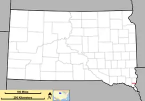 Route of SD 48 (in red) | ||||
| Route information | ||||
| Defined by SDCL §31-4-168 | ||||
| Maintained by SDDOT | ||||
| Length | 12.462 mi[1] (20.056 km) | |||
| Existed | Circa 1950–present | |||
| Major junctions | ||||
| West end | ||||
| East end | Iowa state line west of Akron, Ia. | |||
| Highway system | ||||
| ||||

Route description
SD 48 begins at a diamond interchange on I‑29 Exit 31, approximately 44 miles (71 km) south of Sioux Falls.[3] From its western teriminus,[4] SD 48 travels due east. It nearly immediately meets County Road 1C (CR 1C), an old alignment of US 77. Two miles (3.2 km) east of the CR 1C intersection, SD 48 passes through the town of Spink.[4]
East of Spink, SD 48 gently curves to the north as it descends a rolling hill towards Brule Creek. After crossing the stream, the highway ascends, bending back to the south to resume its due east course. Over the next several miles, the road remains arrow-straight while traversing gently rolling farmland. Just under 10 miles (16 km) east of I‑29, SD 48 serves as the southern terminus of Highway 11 (SD 11). About 1⁄3 mile (0.54 km) from the SD 11 junction, SD 48 crosses a bridge over West Union Creek;[5] one mile (1.6 km) later, it crosses East Union Creek.[6][1] For the remainder of the route, the road gradually S-curves southwest into the Big Sioux River valley. At the Big Sioux River, the road crosses the Iowa state line and ends.
History
South Dakota 48 was established on a previously unnumbered highway between 1948 and 1953.[7] It began at U.S. Highway 77 (current Union County Road 1C). No significant changes have been made, except for a slight extension to meet Interstate 29 to the west, and a slight realignment at the Iowa border.
Major intersections
| County | Location | mi[1] | km | Destinations | Notes |
|---|---|---|---|---|---|
| Union | | 0.000 | 0.000 | I-29 exit 31, diamond interchange, western terminus | |
| | 9.891 | 15.918 | Southern terminus of northern segment of SD 11 | ||
| | 12.462 | 20.056 | Big Sioux River Road | Iowa state line, former Iowa Highway 403, eastern terminus | |
| 1.000 mi = 1.609 km; 1.000 km = 0.621 mi | |||||
References
- South Dakota Department of Transportation (January 2009). "State Highway Log, Mitchell Region" (PDF). Retrieved 2009-12-03.
- Highway and Street Map of Akron Iowa Archived 2006-05-05 at the Wayback Machine
- South Dakota Department of Transportation. "Transportation Inventory Management". Retrieved 2009-12-03.
- Google (2009-12-03). "South Dakota Highway 48" (Map). Google Maps. Google. Retrieved 2009-12-03.
- U.S. Geological Survey Geographic Names Information System: West Union Creek
- U.S. Geological Survey Geographic Names Information System: East Union Creek
- "South Dakota Highways Page: Highways 31-60".
External links
![]() Media related to South Dakota Highway 48 at Wikimedia Commons
Media related to South Dakota Highway 48 at Wikimedia Commons