Spodnja Sveča
Spodnja Sveča (pronounced [ˈspoːdnja ˈsʋeːtʃa]) is a settlement on the right bank of the Dravinja River in the Municipality of Majšperk in northeastern Slovenia. It lies at the confluence of Dežnica Creek with Skralska Creek, a minor right tributary of the Dravinja. The area is part of the traditional region of Styria. It is now included with the rest of the municipality in the Drava Statistical Region.[2]
Spodnja Sveča | |
|---|---|
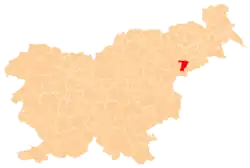
 Spodnja Sveča Location in Slovenia | |
| Coordinates: 46°19′30.19″N 15°43′7.82″E | |
| Country | |
| Traditional region | Styria |
| Statistical region | Drava |
| Municipality | Majšperk |
| Area | |
| • Total | 1.72 km2 (0.66 sq mi) |
| Elevation | 247.2 m (811.0 ft) |
| Population (2002) | |
| • Total | 58 |
| [1] | |
History
Spodnja Sveča became a separate settlement in 1974, when the former village of Sveča was divided into this village and neighboring Zgornja Sveča.[3]
References
- Statistical Office of the Republic of Slovenia
- Majšperk municipal site
- Marinković, Dragan (1991). Abecedni spisak naselja u SFRJ. Promene u sastavu i nazivima naselja za period 1948–1990. Belgrade: Savezni zavod za statistiku. pp. 95, 101, 120.
This article is issued from Wikipedia. The text is licensed under Creative Commons - Attribution - Sharealike. Additional terms may apply for the media files.