Spoluka Point
Spoluka Point (Bulgarian: нос Сполука, ‘Nos Spoluka’ \'nos spo-'lu-ka\) is the ice-covered point on the southwest side of the entrance to Odrin Bay on Nordenskjöld Coast in Graham Land. It was formed as a result of the retreat of the glacier featuring Arrol Icefall in the early 21st century. The feature is named after the settlement of Spoluka in Southern Bulgaria.
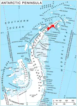
Location of Nordenskjöld Coast on Antarctic Peninsula.
Location
Spoluka Point is located at 64°36′40″S 60°21′45″W, which is 6.9 km southwest of Fothergill Point and 4.35 km north of Cape Worsley. British mapping in 1978.
Maps
- British Antarctic Territory. Scale 1:200000 topographic map. DOS 610 Series, Sheet W 64 60. Directorate of Overseas Surveys, Tolworth, UK, 1978.
- Antarctic Digital Database (ADD). Scale 1:250000 topographic map of Antarctica. Scientific Committee on Antarctic Research (SCAR), 1993–2016.
References
- Spoluka Point. SCAR Composite Antarctic Gazetteer.
- Bulgarian Antarctic Gazetteer. Antarctic Place-names Commission. (details in Bulgarian, basic data in English)
This article includes information from the Antarctic Place-names Commission of Bulgaria which is used with permission.
This article is issued from Wikipedia. The text is licensed under Creative Commons - Attribution - Sharealike. Additional terms may apply for the media files.