Springfield, Georgia
Springfield is a city in Effingham County, Georgia, United States. The population was 2,852 at the 2010 census,[6] up from 1,821 in 2000. The city is the county seat of Effingham County.[7] Springfield is part of the Savannah Metropolitan Statistical Area.
Springfield, Georgia | |
|---|---|
| Motto(s): "Where What's Close to Your Heart Still Matters"[1] | |
 Location in Effingham County and the state of Georgia | |
| Coordinates: 32°22′6″N 81°18′37″W | |
| Country | United States |
| State | Georgia |
| County | Effingham |
| Government | |
| • Mayor | Barton Alderman |
| Area | |
| • Total | 3.08 sq mi (7.98 km2) |
| • Land | 3.08 sq mi (7.98 km2) |
| • Water | 0.00 sq mi (0.00 km2) |
| Elevation | 79 ft (24 m) |
| Population (2010) | |
| • Total | 2,852 |
| • Estimate (2019)[3] | 4,084 |
| • Density | 1,325.11/sq mi (511.70/km2) |
| Time zone | UTC-5 (EST) |
| • Summer (DST) | UTC-4 (EDT) |
| ZIP code | 31329 |
| Area code(s) | 912 |
| FIPS code | 13-72780[4] |
| GNIS feature ID | 0333107[5] |
| Website | City of Springfield Georgia |
History
Springfield was established in 1799, and most likely was named after a plantation.[8] The Georgia General Assembly incorporated Springfield in 1838.[9]
Geography
Springfield is located in central Effingham County at 32°22′6″N 81°18′37″W (32.368240, -81.310152).[10] Georgia State Route 21 bypasses the city center on the west, while Route 119 passes closer to the center of town. Via GA 21 it is 26 miles (42 km) south to Savannah and 33 miles (53 km) northwest to Sylvania, while GA 119 leads southwest 5 miles (8 km) to Guyton and north 12 miles (19 km) to the South Carolina border.
According to the United States Census Bureau, Springfield has a total area of 2.7 square miles (7.1 km2), all land.[6]
Demographics
| Historical population | |||
|---|---|---|---|
| Census | Pop. | %± | |
| 1870 | 32 | — | |
| 1910 | 504 | — | |
| 1920 | 377 | −25.2% | |
| 1930 | 402 | 6.6% | |
| 1940 | 458 | 13.9% | |
| 1950 | 627 | 36.9% | |
| 1960 | 858 | 36.8% | |
| 1970 | 1,001 | 16.7% | |
| 1980 | 1,075 | 7.4% | |
| 1990 | 1,415 | 31.6% | |
| 2000 | 1,821 | 28.7% | |
| 2010 | 2,852 | 56.6% | |
| 2019 (est.) | 4,084 | [3] | 43.2% |
| U.S. Decennial Census[11] | |||
As of the 2010 United States Census, there were 2,852 people living in the city. The racial makeup of the city was 66.3% White, 28.6% Black, 0.6% Native American, 0.4% Asian, 0.1% Pacific Islander, 0.1% from some other race and 1.2% from two or more races. 2.8% were Hispanic or Latino of any race.
As of the census[4] of 2000, there were 1,821 people, 633 households, and 453 families living in the city. The population density was 854.3 people per square mile (330.1/km2). There were 704 housing units at an average density of 330.3 per square mile (127.6/km2). The racial makeup of the city was 76.28% White, 22.13% African American, 0.38% Native American, 0.05% Asian, 0.11% Pacific Islander, 0.77% from other races, and 0.27% from two or more races. Hispanic or Latino of any race were 2.03% of the population.
There were 633 households, out of which 36.2% had children under the age of 18 living with them, 51.0% were married couples living together, 17.4% had a female householder with no husband present, and 28.3% were non-families. 25.6% of all households were made up of individuals, and 11.5% had someone living alone who was 65 years of age or older. The average household size was 2.48 and the average family size was 2.97.
In the city, the population was spread out, with 24.1% under the age of 18, 9.7% from 18 to 24, 30.2% from 25 to 44, 18.9% from 45 to 64, and 17.1% who were 65 years of age or older. The median age was 36 years. For every 100 females, there were 96.7 males. For every 100 females age 18 and over, there were 93.8 males.
The median income for a household in the city was $36,544, and the median income for a family was $41,071. Males had a median income of $35,096 versus $25,192 for females. The per capita income for the city was $16,519. About 11.1% of families and 13.4% of the population were below the poverty line, including 17.4% of those under age 18 and 8.6% of those age 65 or over.
Education
Effingham County School District
The Effingham County School District holds pre-school to grade twelve, and consists of eight elementary schools, three middle schools, and two high schools.[12] The district has 511 full-time teachers and over 9,037 students.[13]
- Blandford Elementary School
- Ebenezer Elementary School
- Guyton Elementary School
- Marlow Elementary School
- Rincon Elementary School
- Sand Hill Elementary School
- South Effingham Elementary School
- Springfield Elementary School
- Ebenezer Middle School
- Effingham County Middle School
- South Effingham Middle School
- Effingham County High School
- South Effingham High School
Notable people
- Paul Carrington - professional football player
- Charlton W. Tebeau - historian
- Artie Ulmer - professional football player
- Dusty Zeigler - professional football player
- Josh Reddick - professional baseball player
- Ryan Ambrose - TMC 2019 Rookie of the Year
References
- "City of Springfield Georgia". City of Springfield Georgia. Retrieved September 4, 2012.
- "2019 U.S. Gazetteer Files". United States Census Bureau. Retrieved July 9, 2020.
- "Population and Housing Unit Estimates". United States Census Bureau. May 24, 2020. Retrieved May 27, 2020.
- "U.S. Census website". United States Census Bureau. Retrieved 2008-01-31.
- "US Board on Geographic Names". United States Geological Survey. 2007-10-25. Retrieved 2008-01-31.
- "Geographic Identifiers: 2010 Demographic Profile Data (G001): Springfield city, Georgia". American Factfinder. U.S. Census Bureau. Archived from the original on February 13, 2020. Retrieved January 26, 2016.
- "Find a County". National Association of Counties. Retrieved 2011-06-07.
- Krakow, Kenneth K. (1975). Georgia Place-Names: Their History and Origins (PDF). Macon, GA: Winship Press. p. 211. ISBN 0-915430-00-2.
- "City of Springfield". GeorgiaInfo. Retrieved 11 June 2019.
- "US Gazetteer files: 2010, 2000, and 1990". United States Census Bureau. 2011-02-12. Retrieved 2011-04-23.
- "Census of Population and Housing". Census.gov. Retrieved June 4, 2015.
- Georgia Board of Education, Retrieved June 8, 2010.
- School Stats, Retrieved June 8, 2010.
External links
| Wikimedia Commons has media related to Springfield, Georgia. |
- City of Springfield official website
- Springfield at CityData.com
Municipalities and communities of Effingham County, Georgia, United States | ||
|---|---|---|
| Cities | 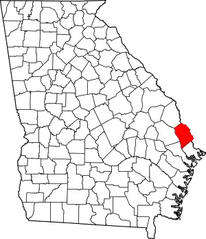 Map of Georgia highlighting Effingham County | |
| Town | ||
| Unincorporated communities | ||
| Ghost town | ||
| ||
