St. Croix Falls, Wisconsin
St. Croix Falls is a city in Polk County, Wisconsin, United States. The population was 2,133 at the 2010 census. The city is located within the Town of St. Croix Falls.
St. Croix Falls | |
|---|---|
City | |
 Businesses in Downtown St. Croix Falls July 2018 | |
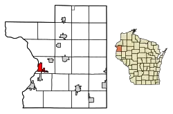 Location of St. Croix Falls in Polk County, Wisconsin. | |
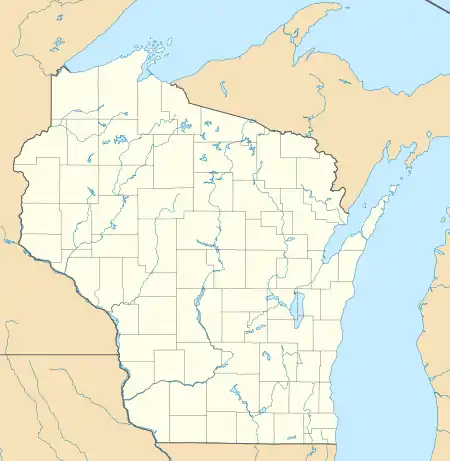 St. Croix Falls Location within the state of Wisconsin  St. Croix Falls Location within the United States | |
| Coordinates: 45°24′43″N 92°38′20″W | |
| Country | |
| State | |
| County | Polk |
| Area | |
| • Total | 5.12 sq mi (13.25 km2) |
| • Land | 4.98 sq mi (12.91 km2) |
| • Water | 0.13 sq mi (0.34 km2) |
| Population | |
| • Total | 2,133 |
| • Estimate (2019)[3] | 2,046 |
| • Density | 410.51/sq mi (158.49/km2) |
| Time zone | UTC-6 (Central (CST)) |
| • Summer (DST) | UTC-5 (CDT) |
| ZIP codes | 54024 |
| Area code(s) | 715 & 534 |
| FIPS code | 55-70550 |
| Website | Official website |
U.S. Route 8, Wisconsin Highway 35, and Wisconsin Highway 87 are three of the main arterial routes in the city.
Geography
St. Croix Falls is located at 45°24′43″N 92°38′20″W (45.411956, -92.638916).[4]
According to the United States Census Bureau, the city has a total area of 4.78 square miles (12.38 km2), of which, 4.67 square miles (12.10 km2) is land and 0.11 square miles (0.28 km2) is water.[5]
St. Croix Falls is adjacent to Taylors Falls, Minnesota, across The St. Croix River.
Demographics
| Historical population | |||
|---|---|---|---|
| Census | Pop. | %± | |
| 1870 | 288 | — | |
| 1880 | 216 | −25.0% | |
| 1890 | 745 | 244.9% | |
| 1900 | 622 | −16.5% | |
| 1910 | 569 | −8.5% | |
| 1920 | 825 | 45.0% | |
| 1930 | 952 | 15.4% | |
| 1940 | 1,007 | 5.8% | |
| 1950 | 1,065 | 5.8% | |
| 1960 | 1,249 | 17.3% | |
| 1970 | 1,425 | 14.1% | |
| 1980 | 1,497 | 5.1% | |
| 1990 | 1,640 | 9.6% | |
| 2000 | 2,033 | 24.0% | |
| 2010 | 2,133 | 4.9% | |
| 2019 (est.) | 2,046 | [3] | −4.1% |
| U.S. Decennial Census[6] | |||
2016 census
As of the census[2] of 2016, there were 2,093 people, 967 households, and 522 families living in the city. The population density was 456.7 inhabitants per square mile (176.3/km2). There were 1,088 housing units at an average density of 233.0 per square mile (90.0/km2). The racial makeup of the city was 96.7% White, 0.3% African American, 0.5% Native American, 0.6% Asian, 0.4% from other races, and 1.5% from two or more races. Hispanic or Latino of any race were 1.8% of the population.
There were 967 households, of which 26.0% had children under the age of 18 living with them, 39.1% were married couples living together, 11.2% had a female householder with no husband present, 3.7% had a male householder with no wife present, and 46.0% were non-families. 40.2% of all households were made up of individuals, and 18.8% had someone living alone who was 65 years of age or older. The average household size was 2.14 and the average family size was 2.87.
The median age in the city was 44.3 years. 22.1% of residents were under the age of 18; 7% were between the ages of 18 and 24; 22% were from 25 to 44; 27.1% were from 45 to 64; and 21.8% were 65 years of age or older. The gender makeup of the city was 44.9% male and 55.1% female.
2000 census
As of the census[7] of 2000, there were 2,033 people, 872 households, and 504 families living in the city. The population density was 607.1 people per square mile (234.3/km2). There were 926 housing units at an average density of 276.5 per square mile (106.7/km2). The racial makeup of the city was 98.43% White, 0.05% Black or African American, 0.30% Native American, 0.20% Asian, 0.54% from other races, and 0.49% from two or more races. 1.33% of the population were Hispanic or Latino of any race.
There were 872 households, out of which 30.0% had children under the age of 18 living with them, 47.2% were married couples living together, 8.1% had a female householder with no husband present, and 42.1% were non-families. 36.8% of all households were made up of individuals, and 19.0% had someone living alone who was 65 years of age or older. The average household size was 2.22 and the average family size was 2.96.
In the city, the population was spread out, with 24.0% under the age of 18, 6.9% from 18 to 24, 26.1% from 25 to 44, 22.2% from 45 to 64, and 20.8% who were 65 years of age or older. The median age was 41 years. For every 100 females, there were 88.4 males. For every 100 females age 18 and over, there were 84.1 males.
The median income for a household in the city was $39,350, and the median income for a family was $54,063. Males had a median income of $40,185 versus $25,341 for females. The per capita income for the city was $21,384. About 2.9% of families and 5.8% of the population were below the poverty line, including 4.4% of those under age 18 and 10.9% of those age 65 or over.
Education
St. Croix Falls School District is the local school district. St. Croix Falls High School is the local high school.
Points of interest
.jpg.webp)
St. Croix Falls abuts two parks whose focal points are the St. Croix River (Wisconsin-Minnesota). It is home to the Park Headquarters for the St. Croix National Scenic Riverway, and it lies adjacent to the Interstate Park, a state park of Minnesota and Wisconsin that spans the Minnesota-Wisconsin state line along the St. Croix River Dalles with parts of the park on both sides.
St. Croix Falls is the western terminus of the Ice Age Trail and the Gandy Dancer State Trail.
The St. Croix Falls Dam was built over the city's namesake falls.
The Cushing Land Agency Building, Lamar Community Center and Thomas Henry Thompson House are located in St. Croix Falls.
St. Croix Dock is located in St. Croix Falls. People can rent kayaks and canoes to enjoy the St. Croix River.
Notable people

- Vernon A. Forbes, Oregon State Representative
- Donald L. Iverson, Wisconsin State Representative
- Megan Kalmoe, U.S. Olympian
- William R. Marshall, Governor of Minnesota
- James Henry McCourt, Wisconsin State Representative
- John Morgan, U.S. Navy Vice Admiral
- Roy Patterson, who played Major League Baseball for the Chicago White Sox from 1901 through 1907.
- James Breck Perkins, author, United States House of Representatives
See also
References
- "2019 U.S. Gazetteer Files". United States Census Bureau. Retrieved August 7, 2020.
- "U.S. Census website". United States Census Bureau. Retrieved 2012-11-18.
- "Population and Housing Unit Estimates". United States Census Bureau. May 24, 2020. Retrieved May 27, 2020.
- "US Gazetteer files: 2010, 2000, and 1990". United States Census Bureau. 2011-02-12. Retrieved 2011-04-23.
- "US Gazetteer files 2010". United States Census Bureau. Archived from the original on 2012-01-24. Retrieved 2012-11-18.
- "Census of Population and Housing". Census.gov. Retrieved June 4, 2015.
- "U.S. Census website". United States Census Bureau. Retrieved 2008-01-31.
External links
| Wikimedia Commons has media related to St. Croix Falls, Wisconsin. |
| Wikivoyage has a travel guide for St. Croix Falls. |
- City of St. Croix Falls
- Falls Chamber of Commerce
- Sanborn fire insurance maps: 1885 1892 1899 1917
Municipalities and communities of Polk County, Wisconsin, United States | ||
|---|---|---|
| Cities |  | |
| Villages | ||
| Towns | ||
| CDP | ||
| Unincorporated communities | ||
| Indian reservations | ||
| Footnotes | ‡This populated place also has portions in an adjacent county or counties | |
| ||
| Authority control |
|---|