St. Regis, Montana
St. Regis is an unincorporated community and census-designated place (CDP) in Mineral County, Montana, United States. The population was 319 at the 2010 census.[1]
St. Regis, Montana | |
|---|---|
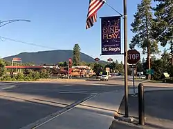 Center of St. Regis in 2019 | |
 Location of St. Regis, Montana | |
| Coordinates: 47°17′58″N 115°6′1″W | |
| Country | United States |
| State | Montana |
| County | Mineral |
| Area | |
| • Total | 0.88 sq mi (2.28 km2) |
| • Land | 0.86 sq mi (2.22 km2) |
| • Water | 0.02 sq mi (0.06 km2) |
| Elevation | 2,635 ft (803 m) |
| Population (2010) | |
| • Total | 319 |
| • Density | 372/sq mi (143.8/km2) |
| Time zone | UTC-7 (Mountain (MST)) |
| • Summer (DST) | UTC-6 (MDT) |
| ZIP Code | 59866 |
| Area code(s) | 406 |
| FIPS code | 30-65575 |
| GNIS feature ID | 0776134 |
Geography
St. Regis is located at 47°17′58″N 115°6′1″W (47.299477, −115.100277),[2] at the confluence of the St. Regis River and the Clark Fork. It is on Montana Highway 135, a shortcut to Glacier National Park.[3] Interstate 90 runs along the southern edge of the community, with access from Exit 33. I-90 leads southeast 71 miles (114 km) to Missoula and west 93 miles (150 km) to Coeur d'Alene, Idaho.
According to the United States Census Bureau, the St. Regis CDP has a total area of 0.9 square miles (2.3 km2), of which 0.02 square miles (0.06 km2), or 2.65%, are water.[1]
Climate
This climatic region is typified by large seasonal temperature differences, with warm to hot (and often humid) summers and cold (sometimes severely cold) winters. According to the Köppen Climate Classification system, St. Regis has a humid continental climate, abbreviated "Dfb" on climate maps.[4]
Demographics
As of the census[5] of 2010, there were 319 people, 135 households, and 73 families residing in the CDP. The population density was 381.4 people per square mile (146.5/km2). There were 161 housing units at an average density of 194.9 per square mile (74.9/km2). The racial makeup of the CDP was 95.87% White, 2.54% Native American, 0.32% Asian, and 1.27% from two or more races. Hispanic or Latino of any race were 2.54% of the population.
There were 135 households, out of which 25.2% had children under the age of 18 living with them, 41.5% were married couples living together, 9.6% had a female householder with no husband present, and 45.2% were non-families. 38.5% of all households were made up of individuals, and 11.1% had someone living alone who was 65 years of age or older. The average household size was 2.33 and the average family size was 3.09.
In the CDP, the population was spread out, with 27.3% under the age of 18, 7.9% from 18 to 24, 26.3% from 25 to 44, 25.1% from 45 to 64, and 13.3% who were 65 years of age or older. The median age was 39 years. For every 100 females, there were 107.2 males. For every 100 females age 18 and over, there were 106.3 males.
The median income for a household in the CDP was $23,750, and the median income for a family was $27,750. Males had a median income of $29,250 versus $14,844 for females. The per capita income for the CDP was $14,137. About 18.2% of families and 21.0% of the population were below the poverty line, including 27.3% of those under age 18 and 15.2% of those age 65 or over.
TV broadcast stations around St. Regis include:
- K05DS (now KSRM-LD), Channel 5, licensed to St. Regis
- K10HM (also subchannel of KPAX-TV, licensed from Missoula), Channel 10, licensed to St. Regis
- K29ID-D, Channel 29, licensed from Weeksville
- K48LG-D, Channel 34, licensed from Plains
Some of the strongest AM radio stations in St. Regis include:
Some of the strongest FM radio stations in St. Regis include:
References
- "Geographic Identifiers: 2010 Census Summary File 1 (G001): St. Regis CDP, Montana". American Factfinder. U.S. Census Bureau. Archived from the original on February 13, 2020. Retrieved August 3, 2019.
- "US Gazetteer files: 2010, 2000, and 1990". United States Census Bureau. 2011-02-12. Retrieved 2011-04-23.
- "St. Regis". Montana Official State Travel Site. Retrieved 2013-11-21.
- Climate Summary for St. Regis, Montana
- "U.S. Census website". United States Census Bureau. Retrieved 2008-01-31.
External links
- Clark Fork Valley-Press and Mineral Independent newspapers
- Visit Montana: St. Regis
- St. Regis Community Schools
Municipalities and communities of Mineral County, Montana, United States | ||
|---|---|---|
| Towns | 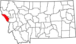 Mineral County map | |
| CDPs | ||
| Unincorporated communities | ||
| ||