St Sepulchre (parish)
St Sepulchre was an ancient parish which was split into two parts throughout its history.
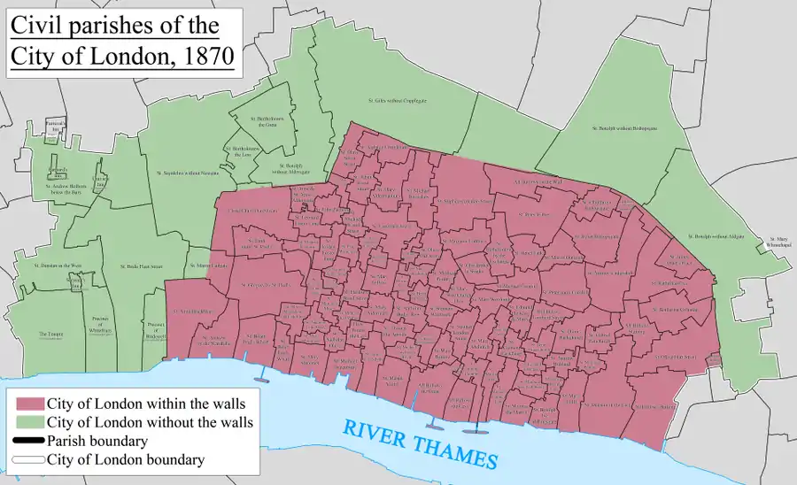
For civil purposes it was divided into two parishes: St Sepulchre without Newgate in the Farringdon Without Ward of the City of London, with a smaller area known as St Sepulchre Middlesex, located outside the City, to the north, in an area of Middlesex that is now part of the London Borough of Islington.
From 1547 the area covered by the civil parish of St Sepulchre Middlesex broke off to become, for ecclesiastic purposes, part of a different parish. This area (now part of the London Borough of Islington), has, since the 19th century, been generally viewed as part of Clerkenwell,[1] though it has never been part of any Clerkenwell administrative or ecclesiastical unit.
Divided parish
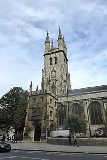
The church of St Sepulchre-without-Newgate was established, probably in the early 1100's,[2] immediately to the west of Newgate, one of the gates in London's Wall.
For civil purposes it was divided into two civil parishes, each called St Sepulchre,[3] although the parish in the City of London was also known as St Sepulchre without Newgate.[4][5]
The River Fleet (now covered by Farringdon Street and Farringdon Road) formed the western boundary of both parishes, with Holborn on the western bank.
An established division
The number of parishes in England grew as more churches were built, especially in the 11th and 12th centuries, leading to the sub-division of parishes, this process ended when the introduction of Canon Law, around 1180,[6] made the sub-division of parishes, or even boundary changes, an onerous and infrequent event. At this point parishes took a settled form.
The extension of the authority of the City beyond the walls took place long before the Norman Conquest and long before the extramural area was settled to any significant degree. The City Wards were also taking shape before the Norman Conquest.[7] The parish of St Sepulchre has therefore probably always been split into its City and northern divisions.
The northern boundary of the City in this area, and therefore the dividing line between the two parishes of St Sepulchre, was initially formed in part by the now culverted Fagswell Brook[8] and once marked by boundary markers known as West Smithfield Bars which were in place by 1170.[9] The City’s sinuous boundary line, subsequently partially covered by Smithfield Market, has been rationalised to follow Charterhouse Street.
St Sepulchre without Newgate
The civil parish of St Sepulchre without Newgate was part of the Farringdon Without Ward of the City of London. Unlike the area to the north, it remained part of the ecclesiastic parish after 1547.
St Sepulchre Middlesex
The civil parish of St Sepulchre Middlesex was part of the Ossulstone Hundred, and later the Finsbury Division, of Middlesex. The two civil parishes were united for ecclesiastical (church) purposes until 1547,[10] when the Middlesex part was split off and merged with other areas to form a new separate new ecclesiastical parish.
In 1900 it became part of the Metropolitan Borough of Finsbury, and in 1965 part of the London Borough of Islington.
End of the civil and ecclesiastic parishes
The civil parish in the City of London was abolished in 1907, with the civil parish in what is now the London Borough of Islington following in 1915.
The ecclesiastical parish, limited to the City since 1547, continued until 1954 when its area was divided between two new consolidated parish areas, including one named St Sepulchre with Christ Church, Greyfriars and St Leonard, Foster Lane.[11]
Population
- St Sepulchre, City of London
| Year | 1871 | 1881 | 1891 | 1901 |
|---|---|---|---|---|
| Population | 3,701 | 2,166 | 1,754 | 1,160 |
- St Sepulchre, Middlesex
| Year | 1871 | 1881 | 1891 | 1901 | 1911 |
|---|---|---|---|---|---|
| Population | 2,888 | 2,392 | 1,972 | 1,503 | 1,192 |
References
- 'Introduction', in Survey of London: Volume 46, South and East Clerkenwell, ed. Philip Temple (London, 2008), pp. 3-27. British History Online http://www.british-history.ac.uk/survey-london/vol46/pp3-27 [accessed 24 October 2020].
- "London, 800-1216". Brooke and Keir, p144
- Youngs, Frederic (1979). Guide to the Local Administrative Units of England. I: Southern England. London: Royal Historical Society. ISBN 0-901050-67-9.
- Great Britain Historical GIS / University of Portsmouth, St Sepulchre (City of London). Retrieved 9 September 2010.
- Great Britain Historical GIS / University of Portsmouth, St Sepulchre (Middlesex). Retrieved 9 September 2010.
- History of the Countryside by Oliver Rackham, 1986 p19
- Process, terms and sources described in detail in "London, 800-1216". Brooke and Keir, Chapter 7
- From a map based on Stow c 1600, (discussed in "Street-names of the City of London", (1954) by Eilert Ekwall) shows the "Fagswell Brook" south of Cowcross Street as the northern boundary of the City)
- 'St John Street: Introduction; west side', in Survey of London: Volume 46, South and East Clerkenwell, ed. Philip Temple (London, 2008), pp. 203-221. British History Online http://www.british-history.ac.uk/survey-london/vol46/pp203-221 [accessed 24 October 2020].
- Youngs, Frederic (1979). Guide to the Local Administrative Units of England. I: Southern England. London: Royal Historical Society. ISBN 0-901050-67-9 p304
- Youngs p 303
History of the formation of the London Borough of Islington | ||
|---|---|---|
| Metropolitan boroughs |  | |
| District boards | ||
| Parishes | ||