Staffelsee
The Staffelsee is a lake in the Garmisch-Partenkirchen district of Bavaria, Germany. The settlements of Murnau, Seehausen and Uffing lie on its shores. Within its 7 km2 (2.7 sq mi) area lie seven islands, the largest and only inhabited of which is Wörth. Wörth was the site of Staffelsee Abbey, a Carolingian monastery founded in the 8th century and dissolved in the 11th century.
| Staffelsee | |
|---|---|
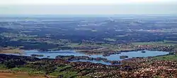
 Staffelsee from the east | |
 Staffelsee | |
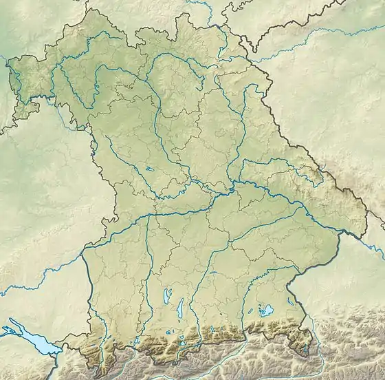
| Location | Murnau am Staffelsee, Garmisch-Partenkirchen |
| Coordinates | 47.689°N 11.163°E |
| Primary inflows | River Ach |
| Primary outflows | River Ach |
| Catchment area | 80.66 km2 (31.14 sq mi)[1] |
| Basin countries | Germany |
| Max. length | 9.575 kilometres (5.950 mi)[1] |
| Max. width | 6.838 kilometres (4.249 mi)[1] |
| Surface area | 7.66 square kilometres (2.96 sq mi)[1] |
| Average depth | 9.8 metres (32 ft)[1] |
| Max. depth | 39.4 metres (129 ft)[1] |
| Water volume | 74.88×10⁶ m3 (60,710 acre⋅ft)[1] |
| Shore length1 | 19.31 kilometres (12.00 mi)[1] |
| Surface elevation | 649 metres (2,129 ft)[2] |
| Islands | 7[3] |
| 1 Shore length is not a well-defined measure. | |
Boat trips aboard the MS Seehausen (built 2009) connect the landing stages of Seehausen, Uffing and Achele (Murnau) between April and October.[3] The surface of the lake is, on average, 649 metres (2,129 ft) above sea level,[2] and at its deepest it is around 40 metres (130 ft) deep.[1]
The main inflow and outflow of the lake is the River Ach, which enters from the west and departs to the north.[2]
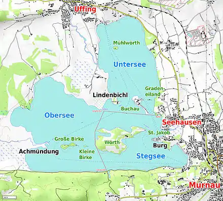
The northeastern part of the lake is known as Untersee, the southeastern part as Stegsee and the southwestern part as Obersee (see map below).
References
- "Dokumentation von Zustand und Entwicklung der wichtigsten Seen Deutschlands: Teil 11 Bayern" (PDF) (in German). Retrieved 22 October 2012.
- BY 7: Ammergebirge Ost, Pürschling. Hörnle (Map). 1:25000. Alpenvereinskarte Bayerische Alpen. Deutscher Alpenverein. 2009.
- "Schiffart auf dem Staffelsee". Retrieved 22 October 2012.

