Stari Grad, Krško
Stari Grad (pronounced [ˈstaːɾi ˈɡɾaːt]; German: Altenhausen[2]) is a settlement east of the town of Krško in eastern Slovenia. The area is part of the traditional region of Styria. It is now included with the rest of the municipality in the Lower Sava Statistical Region.[3]
Stari Grad
Stari Grad pri Vidmu (until 1990) | |
|---|---|
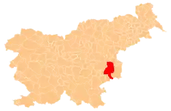
 Stari Grad Location in Slovenia | |
| Coordinates: 45°56′49.79″N 15°32′16.76″E | |
| Country | |
| Traditional region | Styria |
| Statistical region | Lower Sava |
| Municipality | Krško |
| Area | |
| • Total | 0.41 km2 (0.16 sq mi) |
| Elevation | 156.8 m (514.4 ft) |
| Population (2002) | |
| • Total | 237 |
| [1] | |
Name
The name of the settlement was changed from Stari Grad pri Vidmu to Stari Grad in 1990.[4] In the past the German name was Altenhausen.[2]
Mass grave
Stari Grad is the site of a mass grave from the end of the Second World War. The Stari Grad Mass Grave (Slovene: Grobišče Stari Grad) is located on the north side of the road from Krško to Brežice. It contains the remains of an unknown number of Croatian refugees.[5]
Church
The local church is dedicated to Saint Nicholas (Slovene: sveti Miklavž) and belongs to the Parish of Videm–Krško. It is a Baroque church, built in 1627 to commemorate the victims of the plague.[6]
References
- Statistical Office of the Republic of Slovenia
- Leksikon občin kraljestev in dežel zastopanih v državnem zboru, vol. 4: Štajersko. Vienna: C. Kr. Dvorna in Državna Tiskarna. 1904. p. 10.
- Krško municipal site
- Spremembe naselij 1948–95. 1996. Database. Ljubljana: Geografski inštitut ZRC SAZU, DZS.
- Ferenc, Mitja (December 2009). "Grobišče Stari Grad". Geopedia (in Slovenian). Ljubljana: Služba za vojna grobišča, Ministrstvo za delo, družino in socialne zadeve. Retrieved May 3, 2020.
- Slovenian Ministry of Culture register of national heritage reference number ešd 3487
External links