Stoulton
Stoulton or Stoughton[1] is a village and civil parish about 5 miles south west of Worcester,[2] in the Wychavon district, in the county of Worcestershire, England. The parish includes the hamlet of Hawbridge.[3] In 2011 the parish had a population of 453.[4] The parish touches Norton Juxta Kempsey, Whittington, Peopleton, Drakes Broughton and Wadborough and White Ladies Aston.[5] Many houses in the village date from the 17th century.[6] The scientist and cleric William Derham, the first man to accurately measure the speed of sound, was born in Stoulton in 1657.[7]
| Stoulton | |
|---|---|
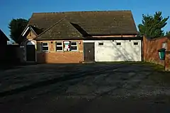 village hall | |
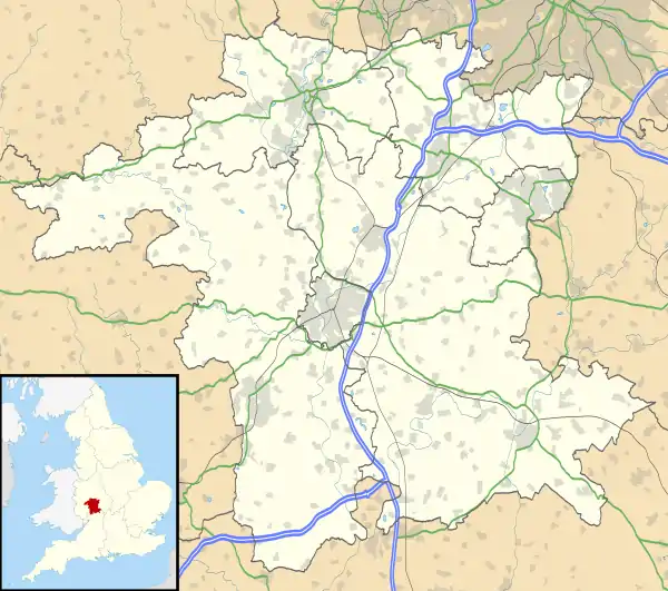 Stoulton Location within Worcestershire | |
| Area | 7.9202 km2 (3.0580 sq mi) |
| Population | 453 (2011 census) |
| • Density | 57/km2 (150/sq mi) |
| Civil parish |
|
| District | |
| Shire county | |
| Region | |
| Country | England |
| Sovereign state | United Kingdom |
| Post town | Worcester |
| Postcode district | WR7 |
| UK Parliament | |
Features
There are 20 listed buildings in Stoulton.[8] Stoulton railway station opened in 1854 and closed in 1966 although it was in the parish of Drakes Broughton and Wadborough.[9] The church is 12th century.[10] Upper Wolverton was a village in the parish that is thought to have been depopulated before 1550, the site currently has 2 farms.[11] Lower Wolverton was possibly also a village in the parish.[12]
History
The name "Stoulton" means 'Stool farm/settlement'.[13] Stoulton was recorded in the Domesday Book as Stoltun.[14] Stoulton was "Stoltun" in the 9th and 11th centuries, "Stulton" in the 15th century and "Stowton" in the 17th century.[15] On the 25th of March 1885 Cookes Holme was transferred to the parish of Norton Juxta Kempsey. The transferred area contained 1 house in 1891.[16]
References
- "Stoulton". GENUKI. Archived from the original on 17 May 2019. Retrieved 17 May 2019.
- "History of History of Stoulton, in Wychavon and Worcestershire". A Vision of Britain through Time. Archived from the original on 17 May 2019. Retrieved 17 May 2019.
- "STOULTON HISTORY". Stoulton History. Archived from the original on 17 May 2019. Retrieved 17 May 2019.
- UK Census (2011). "Local Area Report – Stoulton Parish (E04010434)". Nomis. Office for National Statistics. Retrieved 17 May 2019.
- "Stoulton". Ordnance Survey. Archived from the original on 4 September 2012. Retrieved 17 May 2019.
- "Parish Website of Stoulton". Worcestershire County Council. Archived from the original on 4 March 2016. Retrieved 17 May 2019.
- Smolenaars, Marja. ‘Derham, William (1657–1735) Archived 2015-09-24 at the Wayback Machine’, Oxford Dictionary of National Biography, Oxford University Press, 2004. Accessed 17 May 2018.
- "Listed Buildings in Stoulton, Wychavon, Worcestershire". British Listed Buildings. Archived from the original on 17 May 2019. Retrieved 17 May 2019.
- Historic England, "Stoulton station (509150)", PastScape, retrieved 17 May 2019
- Historic England, "St Edmunds Church (118029)", PastScape, retrieved 17 May 2019
- Historic England, "Upper Wolverton DMV site (118322)", PastScape, retrieved 17 May 2019
- Historic England, "Lower Wolverton Poss. DMV (118335)", PastScape, retrieved 17 May 2019
- "Stoulton Key to English Place-names". The University of Nottingham. Archived from the original on 17 May 2019. Retrieved 17 May 2019.
- "Worcestershire S-Z". The Domesday Book Online. Archived from the original on 6 August 2018. Retrieved 17 May 2019.
- "Parishes: Stoulton". British History Online. Archived from the original on 17 May 2019. Retrieved 17 May 2019.
- "Relationships and Changes Stoulton Tn/CP through time". A Vision of Britain through Time. Archived from the original on 17 May 2019. Retrieved 17 May 2019.
| Wikimedia Commons has media related to Stoulton. |