Straß in Steiermark
Straß in Steiermark is a municipality in the district of Leibnitz in the Austrian state of Styria.
Straß in Steiermark | |
|---|---|
 Coat of arms | |
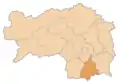
 Straß in Steiermark Location within Austria | |
| Coordinates: 46°43′38″N 15°37′28″E | |
| Country | Austria |
| State | Styria |
| District | Leibnitz |
| Government | |
| • Mayor | Reinhold Höflechner (ÖVP) |
| Area | |
| • Total | 28.85 km2 (11.14 sq mi) |
| Elevation | 254 m (833 ft) |
| Population (2018-01-01)[2] | |
| • Total | 4,852 |
| • Density | 170/km2 (440/sq mi) |
| Time zone | UTC+1 (CET) |
| • Summer (DST) | UTC+2 (CEST) |
| Postal code | 8461, 8471, 8472, 8473 |
| Area code | +43 3453, +43 3472 |
| Vehicle registration | LB |
| Website | www.strass.steiermark.gv.at |

Castle Straß
Geography
Straß in Steiermark is situated in the south of Styria, on the border with Slovenia.
Constituent parts of Straß municipality
The municipality comprises the communities of:
Neighbouring municipalities
Places adjacent to Straß in Steiermark | |
|---|---|

Population
| Year | Pop. | ±% |
|---|---|---|
| 1869 | 4,820 | — |
| 1880 | 4,936 | +2.4% |
| 1890 | 5,031 | +1.9% |
| 1900 | 5,064 | +0.7% |
| 1910 | 5,237 | +3.4% |
| 1923 | 5,622 | +7.4% |
| 1934 | 5,924 | +5.4% |
| 1939 | 5,276 | −10.9% |
| 1951 | 5,724 | +8.5% |
| 1961 | 5,471 | −4.4% |
| 1971 | 5,762 | +5.3% |
| 1981 | 5,550 | −3.7% |
| 1991 | 5,681 | +2.4% |
| 2001 | 6,090 | +7.2% |
| 2011 | 6,106 | +0.3% |
| 2020 | 6,349 | +4.0% |
References
- "Dauersiedlungsraum der Gemeinden Politischen Bezirke und Bundesländer - Gebietsstand 1.1.2018". Statistics Austria. Retrieved 10 March 2019.
- "Einwohnerzahl 1.1.2018 nach Gemeinden mit Status, Gebietsstand 1.1.2018". Statistics Austria. Retrieved 9 March 2019.
This article is issued from Wikipedia. The text is licensed under Creative Commons - Attribution - Sharealike. Additional terms may apply for the media files.