Stratford-sub-Castle
Stratford-sub-Castle in Wiltshire, England was anciently a separate village[1] and civil parish but since 1954 has been a northern suburb of the city of Salisbury. At approximately 170 ft above sea level, it is dominated to the east by the remains of an Iron Age hillfort within the boundaries of which a Norman castle was built. This now-ruined castle led to the village taking the name Stratford-under-Castle,[1] later changing to Stratford sub Castle. Stratford lies south-west of the abandoned medieval settlement of Old Sarum which was also built within the area of the hill fort. It is approximately twenty one miles from Southampton.
| Stratford-sub-Castle | |
|---|---|
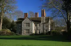
 The Manor House, Stratford sub Castle | |
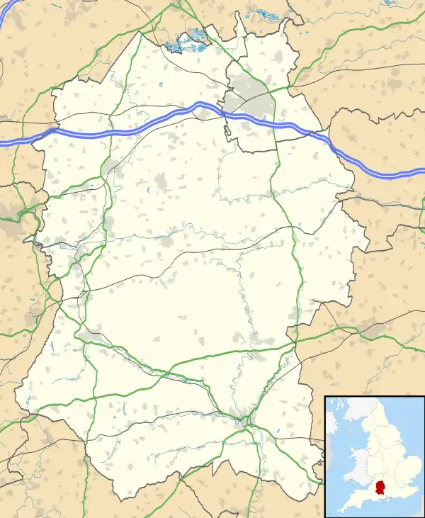
 Stratford-sub-Castle Location within Wiltshire | |
| OS grid reference | SU133323 |
| Unitary authority | |
| Ceremonial county | |
| Region | |
| Country | England |
| Sovereign state | United Kingdom |
| Post town | SALISBURY |
| Postcode district | SP1 |
| Dialling code | 01722 |
| Police | Wiltshire |
| Fire | Dorset and Wiltshire |
| Ambulance | South Western |
| UK Parliament | |
| Website | Community website |

Stratford sub Castle is within the current city boundaries. There is a primary school; the nearest secondary school to the village is South Wilts Grammar School, a five-minute walk away from the southern boundary of Stratford sub Castle, on Stratford Road.
The oldest building in the area is the Church of St Lawrence, a Grade I listed building.[2] Dating from the 13th century, it was restored by Thomas Pitt in 1711 and is still used as a church today. Before his conversion to Roman Catholicism, the hymnist Edward Caswall served as its curate.
Stratford-sub-Castle cannot expand to the east or the west, being bounded by Old Sarum on one side and the River Avon on the other: it has thus become a linear settlement.
Areas within the ward
Stratford-sub-castle is in the St Francis and Stratford ward.[3] Arguably the boundary between the two is the A345 road with Stratford-sub-castle to the west and St Francis to the east. Nowadays, the two areas are prosperous, largely residential suburbs north of the A36 road. The ward of St Francis and Stratford is the least ethnically diverse ward in Salisbury being 94.5% White British in 2011, out of the ward's population which was 5,586.[4]
Also within the ward is the suburb of Paul's Dene which is a housing estate and terminus of a Salisbury Reds bus route.[5] Paul's Dene is on the northern edge of Salisbury, being north-east of Stratford-sub-castle and north of St Francis. All the main attractions in the ward are in Stratford-sub-castle itself, these being Mawarden Court, Victoria Park and Five Rivers leisure centre. A historical feature formerly within the area was the recently demolished Salisbury Gas holder on Coldharbour lane, to the north of the A36 Salisbury ring road. Originally built in 1928, it was taken apart in 2017 by Southern Gas because of high maintenance costs and some local residents considering it an eyesore.
The historic attraction of Old Sarum is within the northern boundary of the ward, but the modern housing and industrial development is just outside it, being further to the east.
References
- Crittall, Elizabeth, ed. (1962). "Victoria County History: Wiltshire: Vol 6 pp199-213 - Stratford-sub-Castle". British History Online. University of London. Retrieved 18 September 2020.
- Historic England. "Church of St Lawrence (1272953)". National Heritage List for England. Retrieved 31 December 2017.
- "Salisbury St Francis and Stratford - UK Census 2011". UK Census Data. Retrieved 31 December 2017.
- "Salisbury St Francis and Stratford - UK Census 2011". UK Census Data. Retrieved 31 December 2017.
- "Salisbury Reds Timetables". Salisbury Reds. Retrieved 31 December 2017.