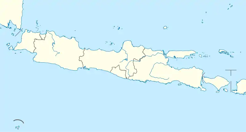
Subang, Indonesia
Subang is a town and the capital of the Subang Regency in West Java, Indonesia. It lies approximately 125 kilometres (78 mi) southeast of Jakarta and 54 kilometres (34 mi) northeast of Bandung by road.[2] As of 2010 the subdistrict area of Subang had a population of 120,346 people.
Subang | |
|---|---|
| Regional transcription(s) | |
| • Sundanese | ᮞᮥᮘᮀ |
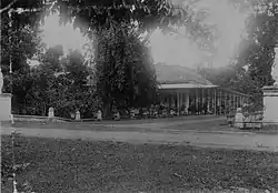 A Subangite colonial villa in the early 20th-century CE | |
| Coordinates: 6°34′17″S 107°45′41″E | |
| Country | |
| Province | West Java |
| Regency | Subang Regency |
| Government | |
| • Camat | Deni Setiawan |
| Area | |
| • Total | 58.45 km2 (22.57 sq mi) |
| Elevation | 88 m (289 ft) |
| Population (2020)[1] | |
| • Total | 127,765 |
| • Density | 2,200/km2 (5,700/sq mi) |
| Time zone | UTC+7 (IWT) |
| Postal code | 4121x |
| Area code | (+62) 260 |
| Villages | 12 |
| Website | Official website |

History
In April 1952 the Harian Rakjat stated that the Communist Party of Indonesia had organized a course in Subang along with Karawang.[3]
Landmarks
The government office Dinas Kesehatan Kabupaten Subang, the House of Representatives of Subang District, the park Alun Alun Kabupaten Subang, and Al-Musabaqoh Grand Mosque are in the town centre. The University of Subang is in the southeast and the football pitch Stadion Persikas lies in the south of the town. P. T. Taekwung Industrial Estate lies on the northeastern outskirts of the town as does a Class II prison in the north. The principal hospital is Rumah Sakit PTPN VIII Hospital.[2]
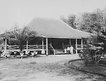
Museum Wisma Karya is a colonial period building and museum in Subang. It contains a range of items from ancient fossils to a bronze statue of P.W. Hofland, which was made in 1878.[4]
Climate
Subang has a borderline tropical rainforest climate (Af) and tropical monsoon climate (Am) with exactly 60 millimetres (2.4 in) in the driest month, August. It has moderate rainfall from June to September and heavy to very heavy rainfall from October to May.
| Climate data for Subang | |||||||||||||
|---|---|---|---|---|---|---|---|---|---|---|---|---|---|
| Month | Jan | Feb | Mar | Apr | May | Jun | Jul | Aug | Sep | Oct | Nov | Dec | Year |
| Average high °C (°F) | 30.2 (86.4) |
30.3 (86.5) |
30.8 (87.4) |
31.5 (88.7) |
31.8 (89.2) |
31.7 (89.1) |
31.8 (89.2) |
32.5 (90.5) |
33.1 (91.6) |
33.2 (91.8) |
32.0 (89.6) |
31.1 (88.0) |
31.7 (89.0) |
| Daily mean °C (°F) | 26.1 (79.0) |
26.2 (79.2) |
26.4 (79.5) |
26.9 (80.4) |
27.0 (80.6) |
26.5 (79.7) |
26.4 (79.5) |
26.8 (80.2) |
27.2 (81.0) |
27.4 (81.3) |
27.0 (80.6) |
26.6 (79.9) |
26.7 (80.1) |
| Average low °C (°F) | 22.1 (71.8) |
22.1 (71.8) |
22.1 (71.8) |
22.3 (72.1) |
22.2 (72.0) |
21.4 (70.5) |
21.1 (70.0) |
21.1 (70.0) |
21.3 (70.3) |
21.7 (71.1) |
22.1 (71.8) |
22.2 (72.0) |
21.8 (71.3) |
| Average rainfall mm (inches) | 468 (18.4) |
398 (15.7) |
411 (16.2) |
325 (12.8) |
237 (9.3) |
118 (4.6) |
94 (3.7) |
60 (2.4) |
70 (2.8) |
166 (6.5) |
304 (12.0) |
398 (15.7) |
3,049 (120.1) |
| Source: Climate-Data.org[5] | |||||||||||||
References
- "Subang Subdistrict in Figures 2020". Statistics Indonesia. Retrieved December 14, 2020.
- Google (15 February 2020). "Subang, Indonesia" (Map). Google Maps. Google. Retrieved 15 February 2020.
- Hindley, Donald (1964). "The Communist Party of Indonesia, 1951-1963". University of California Press. p. 73.
- "Museum Wisma Karya" (in Indonesian). Kotasubang.com. Retrieved 15 February 2020.
- "Climate: Subang". Climate-Data.org. Retrieved 12 November 2020.
| Wikivoyage has a travel guide for Subang (West Java). |