Sugartit, Kentucky
Sugartit (formerly known as Pleasant Ridge and later as Gunpowder in the 1920s)[lower-alpha 1][3][4] is a rural community in Boone County, Kentucky, United States. It was located at the intersection of U.S. Route 42 and Kentucky Route 237 between the cities of Florence and Union.[5] Sugartit has been noted for its unusual place name.[2][6]
Sugartit, Kentucky | |
|---|---|
Former settlement | |
 Sugartit, Kentucky | |
| Coordinates: 38°58′22″N 84°39′46″W | |
| Country | United States |
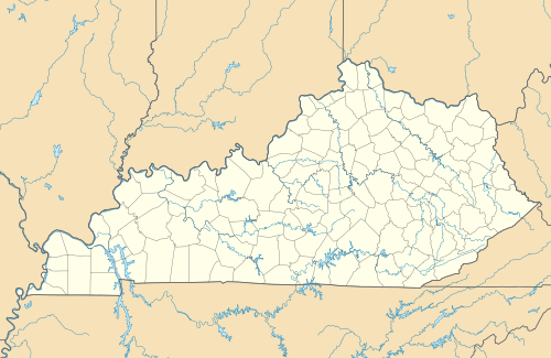
| State | Kentucky |
| County | Boone |
| Elevation | 794 ft (242 m) |
| Time zone | UTC-5 (Eastern (EST)) |
| • Summer (DST) | UTC-4 (EDT) |
| GNIS feature ID | 504705[1] |
The community no longer exists, and it is now essentially a part of the outer Florence metropolitan area.[2][4] The last surviving structure was the Sugartit Asphalt factory.[7]
Etymology
According to one account, the community received the name Sugartit because the local men would go to its general store during the winter months, when less farm work was needed, and return home late for dinner; their wives would remark that they "had to have a sugartit at the store".[3]
History
In 1883, when the community was named Pleasant Ridge, amenities and services included a blacksmith, a general store/paint store, the Pleasant Ridge School, a steam saw and grist mill.[4]
During the time it was named Gunpowder in the 1920s and onward, the community had a post office and general store and a blacksmith shop. Both ceased to exist sometime after the mid 1900s.[4]
In the mid 1960s, few businesses existed, with the Sugartit Asphalt Company and Haines Oil being the only remaining businesses.[4]
Today, the Sugartit area, which "is located on the fringes of the Florence metropolitan area", has several businesses and amenities on Route 42, such as fast food restaurants, a gas station, a car wash, banks, apartments, a body shop, hardware, a church, a pub and other establishments.[4]
Sugartit never became an incorporated town.[4]
Notes
- "according to The Cincinnati Enquirer, "it had the name of Pleasant Ridge as shown on Lake's 1883 Atlas. It was later called Gunpowder and the area is so designated in John Uri Lloyd's book, 'Felix Moses, Beloved Jew.'"[2]
References
- "Sugartit". Geographic Names Information System. United States Geological Survey.
- Clark, Ryan (April 2, 2017). "Get the scoop on all of Northern Kentucky's weird town names, from Rabbit Hash to Sugartit". WCPO. Retrieved September 25, 2018.
- Tenkotte, Paul A.; James C. Claypool (2009). The Encyclopedia of Northern Kentucky. University Press of Kentucky. p. 427.
- Schiffer, Thomas (July 13, 2015). "A history of Boone County's Gunpowder area". Cincinnati.com. Retrieved September 25, 2018.
- State Primary Road System: Boone County (PDF) (Map). Kentucky Transportation Cabinet. 2011. Retrieved June 20, 2012.
- Strecker, Zoe; Finch, Jackie Sheckler (1 July 2009). Kentucky Off the Beaten Path. Rowman & Littlefield. p. 11. ISBN 978-0-7627-5790-9.
- "Union, Kentucky: Town Name Sugartit". RoadsideAmerica.com. Retrieved June 20, 2012.
Municipalities and communities of Boone County, Kentucky, United States | ||
|---|---|---|
| Cities | 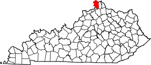 Location of Boone County, Kentucky | |
| CDPs | ||
| Unincorporated Communities | ||
| Ghost town | ||
| Footnotes | ‡This populated place also has portions in an adjacent county or counties. | |
| ||
