Suvereto
Suvereto is a comune (municipality) in the Province of Livorno in the Italian region Tuscany, located about 90 kilometres (56 miles) southwest of Florence and about 60 kilometres (37 mi) southeast of Livorno.
Suvereto | |
|---|---|
| Comune di Suvereto | |
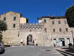 South gate of Suvereto | |
Location of Suvereto 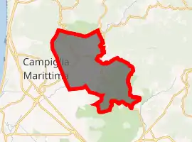
| |
 Suvereto Location of Suvereto in Italy 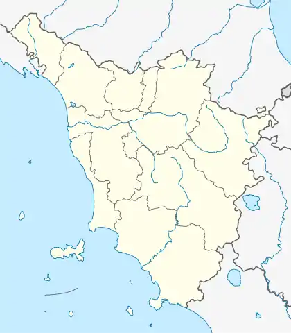 Suvereto Suvereto (Tuscany) | |
| Coordinates: 43°5′N 10°41′E | |
| Country | Italy |
| Region | Tuscany |
| Province | Livorno (LI) |
| Frazioni | Belvedere, Montioni, Prata, San Lorenzo |
| Government | |
| • Mayor | Giuliano Parodi |
| Area | |
| • Total | 92.9 km2 (35.9 sq mi) |
| Elevation | 90 m (300 ft) |
| Population (January 2017)[2] | |
| • Total | 3,035 |
| • Density | 33/km2 (85/sq mi) |
| Demonym(s) | Suveratani |
| Time zone | UTC+1 (CET) |
| • Summer (DST) | UTC+2 (CEST) |
| Postal code | 57028 |
| Dialing code | 0565 |
| Patron saint | Santa Croce |
| Saint day | May 3 |
| Website | Official website |
Main sights
- Rocca Aldobrandesca, ruins of a castle built in the mid-12th century near 9th century fortifications.
- Pieve of San Giusto, a pleban church in Romanesque style
- Countryside church of Santissima Annunziata
- Church of the Crucifix
- Natural Park of Montioni
Technological sites
- Static inverter plant of HVDC SACOI, the HVDC-power cable connecting the power grids of Corse and Sardinia with the grid of the Italian mainland.
- Research centre for switchyards of ENEL, including an experimental 3-kilometre (1.9 mi) long powerline to Valdicciola, which is partly built as underground cable
Frazioni
The municipality is formed by the municipal seat of Suvereto and the villages (frazioni) of Belvedere, Montioni, Prata and San Lorenzo. The small hamlets of Forni, Poggio al Turco, San Lorenzo Due, Tabarò and Valdamone are also included in the municipality.
References
- "Superficie di Comuni Province e Regioni italiane al 9 ottobre 2011". Istat. Retrieved 16 March 2019.
- Istat
| Wikimedia Commons has media related to Suvereto. |
| Authority control |
|---|
This article is issued from Wikipedia. The text is licensed under Creative Commons - Attribution - Sharealike. Additional terms may apply for the media files.
