Sveti Vid, Vuzenica
Sveti Vid (pronounced [ˈsʋeːti ˈʋiːt]) is a settlement in the Municipality of Vuzenica in northern Slovenia. It has a population cluster lying on the right bank of the Drava River, and extends south and upwards, with dispersed properties in the heavily wooded Pohorje Hills. The settlement, and the municipality, are included in the Carinthia Statistical Region, which is in the Slovenian portion of the historical Duchy of Styria.[4]
Sveti Vid | |
|---|---|
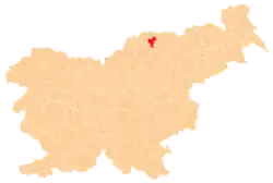
 Sveti Vid Location in Slovenia | |
| Coordinates: 46°36′13.12″N 15°11′17.69″E | |
| Country | |
| Traditional region | Styria |
| Statistical region | Carinthia |
| Municipality | Vuzenica |
| Area | |
| • Total | 10.15 km2 (3.92 sq mi) |
| Elevation | 372.7 m (1,222.8 ft) |
| Population | |
| • Total | 426 |
| • Density | 42/km2 (110/sq mi) |
| [3] | |
The local parish church, from which the settlement gets its name, is dedicated to Saint Vitus (Slovene: sveti Vid) and belongs to the Roman Catholic Archdiocese of Maribor. It was built in the early 15th century.[5]
References
- Razpotnik, Barica (2020-06-08). "On 1 January 2020, 2,095,861 residents of Slovenia lived in 5,978 settlements; 57 settlements were unpopulated" (Press release). Ljubljana: Statistical Office of the Republic of Slovenia. Retrieved 2021-01-09.
final data (XLS attachment)
- Prebivalci po spolu, občine in naselja, Slovenija, 1. januar 2020 [Population by sex, municipalities and resorts, Slovenia, 1 January 2020]. Statistical Office of the Republic of Slovenia (XLS) (in Slovenian). Ljubljana. 2020-06-08. Retrieved 2021-01-09.
(note: for Vuzenica, the municipality is at code 141, followed immediately by its settlements at codes 141001–141105)
- Statistical Office of the Republic of Slovenia
- Vuzenica municipal site
- Slovenian Ministry of Culture register of national heritage reference number ešd 3511
External links
This article is issued from Wikipedia. The text is licensed under Creative Commons - Attribution - Sharealike. Additional terms may apply for the media files.