Szekszárd District
Szekszárd (Hungarian: Szekszárdi járás) is a district in south-eastern part of Tolna County. Szekszárd is also the name of the town where the district seat is found. The district is located in the Southern Transdanubia Statistical Region.
Szekszárd District
Szekszárdi járás | |
|---|---|
 Coat of arms | |
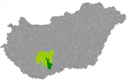 Szekszárd District within Hungary and Tolna County. | |
| Country | |
| County | Tolna |
| District seat | Szekszárd |
| Area | |
| • Total | 656.18 km2 (253.35 sq mi) |
| Area rank | 3rd in Tolna |
| Population (2011 census) | |
| • Total | 60,122 |
| • Rank | 1st in Tolna |
| • Density | 92/km2 (240/sq mi) |
Geography
Szekszárd District borders with Paks District and Tolna District to the north, Baja District (Bács-Kiskun County) to the east, Mohács District (Baranya County) to the south, Bonyhád District and Tamási District to the west. The number of the inhabited places in Szekszárd District is 17.
Municipalities
The district has 1 urban county, 1 town, 1 large village and 14 villages. (ordered by population, as of 1 January 2013)[1]
The bolded municipalities are cities, italics municipality is large village.
See also
References
- "A KSH 2013. évi helységnévkönyve". ksh.hu. Retrieved 2017-12-26.
External links
| City with county rights (1) |
| |
|---|---|---|
| Town (1) | ||
| Large village (1) | ||
| Villages (14) | ||
This article is issued from Wikipedia. The text is licensed under Creative Commons - Attribution - Sharealike. Additional terms may apply for the media files.
