Tabular Hills
The Tabular Hills are an east-west line of distinct hills on the southern boundary of the North York Moors, running from Scarborough in the east to Black Hambleton in the west. The name refers to their flat, tabular summits composed of hard Corallian limestone known locally as "nabs". They form the northern boundary of the Vale of Pickering.

Description
Steep-sided river valleys break through the Tabular Hills to form a broken series of tablet-shaped hills. The most distinctive feature of these is their northern escarpment, which rises to 200 ft (61 m) above the moorland to the north. At their western end, beyond the River Rye, they join with the north-south Hambleton Hills, which have a similar geological basis.[1][2][3]
Striking among the river valleys are Newton Dale and Forge Valley – glacial run-off channels formed by massive melt water denied an exit to the North Sea by glacial ice, pouring over the lowest points in the landscape during the last ice age and cutting steeply sided channels.[4] The Hole of Horcum is a scallop-shaped valley formed by the action of a line of springs.[5]
Tabular Hills walk
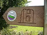
The Tabular Hills walk loosely links the two southerly ends of the Cleveland Way National Trail, enabling walkers to walk the complete perimeter of The North York Moors National Park. It runs from Helmsley in the west to Scalby Mills on the North Sea coast and measures 48 miles (77 km). It crosses sparsely settled countryside between Scalby and Levisham and then touches the villages of Newton-on-Rawcliffe, Cropton, Appleton-le-Moors, Hutton-le-Hole, Gillamoor, Fadmoor and Carlton.[3]
References
- Rickard, John (2005–2009). "Tabular Hill". Moors Knowledge. Retrieved 3 August 2010.
- Sorby, H. C. (1849–59). "On the Excavation of the Valleys in the Tabular Hills, as shown by the Configuration of Yedmandale, near Scarbro'". Proceedings of the Geological and Polytechnic Society of the West Riding of Yorkshire: 3, 169–172. doi:10.1144/pygs.3.169. ISSN 0044-0604.
- Collins, Martin; Dillon, Paddy (2008). "The Tabular Hills". In Paddy Dillon (ed.). The North York Moors: A Walking Guide. Cicerone British Walking British Walking Series. Cicerone Press Limited. p. 21. ISBN 1-85284-448-5.
- "Geology of the Tabular Hills". North York Moors National Park. 11 June 2010. Archived from the original on 28 December 2010. Retrieved 3 August 2010.
- "Levisham Moor and the Hole of Horcum". North York Moors National Park. Retrieved 22 August 2017.
External links
- "Tabular Hills Walk". Long Distance Walkers Association. Retrieved 3 August 2010.
- "Walking Routes". North York Moors National Park. Retrieved 12 January 2013.
