Talwara
Talwara is a census town in Hoshiarpur district in the Indian state of Punjab. It is near to the border of the state of Himachal Pradesh.This place is known for proximity to Pong Dam and was mainly populated during the construction of the same. It is situated on the banks of Pong Left Main Canal. locally known as Shah Neher. It consists of 4 sectors and a main market, where people can get there day to day needs.
Talwara | |
|---|---|
City | |
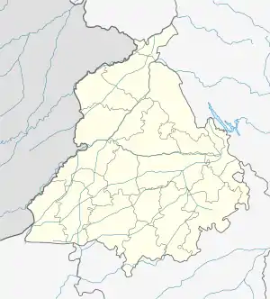
 Talwara Location in Punjab, India | |
| Coordinates: 31.90°N 75.65°E | |
| Country | |
| State | Punjab |
| District | Hoshiarpur |
| Area | |
| • Total | 10 km2 (4 sq mi) |
| Elevation | 326 m (1,070 ft) |
| Population (2011)[1] | |
| • Total | 19,485 |
| • Density | 1,900/km2 (5,000/sq mi) |
| Languages | |
| • Official | Punjabi |
| Time zone | UTC+5:30 (IST) |
| PIN | 144216 |
| Telephone code | 01883 |
| Vehicle registration | PB-07 |
Geography
Talwara is located at 31.95°N 75.87°E.[2] It has an average elevation of 326 metres (1069 ft).
Talwara Township generally known as Talwara is named after a small nearby village name Talwara. It is approximately 75 KM from district headquarter Hoshiarpur City and 28 Km from the Mukerian City. It is situated about 22 Km from the Hindu temple of Mata Chinta-Poorni darbar (in Himanchal Pradesh). It is a town located at the fringes of Shivalik range of mountains. The Pong Dam (the Beas Dam) is also known as TALWARA dam is only 15KM from here.
Demographics
As of 2001 India census,[3] Talwara had a population of 22,580. Males constitute 53% of the population and females 47%. Talwara has an average literacy rate of 80%, higher than the national average of 59.5%: male literacy is 83%, and female literacy is 76%. In Talwara, 11% of the population is under 6 years of age.
References
- http://www.censusindia.gov.in/pca/SearchDetails.aspx?Id=31489
- Falling Rain Genomics, Inc - Talwara
- "Census of India 2001: Data from the 2001 Census, including cities, villages and towns (Provisional)". Census Commission of India. Archived from the original on 16 June 2004. Retrieved 1 November 2008.