Tan-Tan
Tan-Tan (Arabic: طانطان, Berber languages: ⵟⴰⵏⵟⴰⵏ) is a city in Tan-Tan Province in the region of Guelmim-Oued Noun in southwestern Morocco. It is a desert town with a population (2014 census) of 73,209.[1] It is the largest city in the province and second largest city in the region after the capital Guelmim.[2] It is located on the banks of the wadi Oued Ben Jelil, which flows into the Draa River 15 km north of the town. The Draa River at 1,100 km is the longest in Morocco and flows into the Atlantic Ocean soon after the confluence with the wadi. The town also has an airport, Tan Tan Plage Blanche Airport.
Tan-Tan
ⵟⴰⵏⵟⴰⵏ طانطان | |
|---|---|
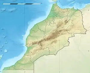 Tan-Tan Location in Morocco 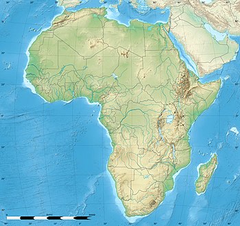 Tan-Tan Tan-Tan (Africa) | |
| Coordinates: 28°26′N 11°06′W | |
| Country | |
| Region | Guelmim-Oued Noun |
| Province | Tan-Tan |
| Elevation | 51 m (167 ft) |
| Population (2014) | |
| • Total | 73,209 |
| Time zone | UTC+1 (CET) |
History
_%D0%B2_%D0%A2%D0%B0%D0%BD-%D0%A2%D0%B0%D0%BD%D0%B5_(%D0%9C%D0%B0%D1%80%D0%BE%D0%BA%D0%BA%D0%BE).jpg.webp)
The quartz figurine Venus of Tan-Tan was found in a river terrace deposit on the north bank of the Draa River. Dated between 200,000 and 500,000 BCE, it is considered one of the oldest human-form sculptures in the world, although its formation may actually be natural.[3]
Port
The nearby port, known as Tan-Tan Plage in French; Port of Tan-Tan in English; and El Ouatia, al-Watiyah or الوطية in Arabic is about 25 kilometres west from Tan-Tan on the Atlantic Ocean. With a population in 2004 of 6,294[2] it is the second largest settlement in the province and ninth in the region. Both Tan-Tan and Tan-Tan Plage are on Morocco's main highway, the N1.
Climate
Tan-Tan has a hot desert climate (Köppen climate classification BWh).
| Climate data for Tan-Tan | |||||||||||||
|---|---|---|---|---|---|---|---|---|---|---|---|---|---|
| Month | Jan | Feb | Mar | Apr | May | Jun | Jul | Aug | Sep | Oct | Nov | Dec | Year |
| Average high °C (°F) | 21 (70) |
22 (72) |
24 (75) |
24 (75) |
24 (75) |
26 (79) |
28 (82) |
28 (82) |
28 (82) |
27 (81) |
26 (79) |
20 (68) |
25 (77) |
| Daily mean °C (°F) | 15 (59) |
16 (61) |
18 (64) |
18 (64) |
19 (66) |
21 (70) |
23 (73) |
22 (72) |
22 (72) |
21 (70) |
19 (66) |
15 (59) |
19 (66) |
| Average low °C (°F) | 10 (50) |
10 (50) |
12 (54) |
13 (55) |
15 (59) |
16 (61) |
18 (64) |
17 (63) |
17 (63) |
15 (59) |
13 (55) |
10 (50) |
14 (57) |
| Average precipitation mm (inches) | 10 (0.4) |
10 (0.4) |
0 (0) |
0 (0) |
0 (0) |
0 (0) |
0 (0) |
0 (0) |
0 (0) |
10 (0.4) |
20 (0.8) |
30 (1.2) |
110 (4.3) |
| Source: Weatherbase[4] | |||||||||||||
See also
References
- "Publications RGPH 2014 | Téléchargements | rgph2014". www.rgph2014.hcp.ma. Retrieved 1 April 2016.
- "Recensement général de la population et de l'habitat 2004". Hcp.ma. Retrieved 15 October 2013.
- "The Tan-Tan Venus". Donsmaps.com. Retrieved 15 October 2013.
- "Weatherbase: Historical Weather for Tan-Tan". Weatherbase.com. Retrieved 15 October 2013.
External links
| Wikimedia Commons has media related to Tan-Tan. |
Capital: Guelmim | ||
| Provinces |  | |
| Cities | ||
Capital:Tan-Tan | ||
| Municipalities | ||
| Rural communes | ||
