Tanudan
Tanudan, officially the Municipality of Tanudan is a 4th class municipality in the province of Kalinga, Philippines. According to the 2015 census, it has a population of 9,534 people. [3]
Tanudan | |
|---|---|
| Municipality of Tanudan | |
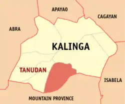 Map of Kalinga with Tanudan highlighted | |
OpenStreetMap 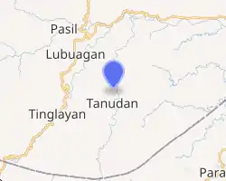
| |
.svg.png.webp) Tanudan Location within the Philippines | |
| Coordinates: 17°18′N 121°14′E | |
| Country | |
| Region | Cordillera Administrative Region (CAR) |
| Province | Kalinga |
| District | Lone District |
| Barangays | 16 (see Barangays) |
| Government | |
| • Type | Sangguniang Bayan |
| • Mayor | Jaedicke Rhoss P. Dagadag |
| • Vice Mayor | Joseph B. Cosidon |
| • Representative | Allen Jesse C. Mangaoang |
| • Electorate | 9,035 voters (2019) |
| Area | |
| • Total | 307.55 km2 (118.75 sq mi) |
| Elevation | 905 m (2,969 ft) |
| Population | |
| • Total | 9,534 |
| • Density | 31/km2 (80/sq mi) |
| • Households | 1,568 |
| Economy | |
| • Income class | 4th municipal income class |
| • Poverty incidence | 38.55% (2015)[4] |
| • Revenue | ₱74,086,051.41 (2016) |
| Time zone | UTC+8 (PST) |
| ZIP code | 3805 |
| PSGC | |
| IDD : area code | +63 (0)74 |
| Climate type | tropical rainforest climate |
| Native languages | Kalinga language Balangao Ilocano Tagalog |
| Website | www |
The town is known for Mount Binaratan. Legend tells that the supreme god of the Kalinga people went into the mountain to hunt but was irritated due to the noises made by the birds, so he ordered the birds to be quiet. When he was done hunting, he forgot to revoke his order from the birds, and thus, the mountain kept silent for all of eternity.[5] Another popular place is the Lubo Village where houses are intact and strategically surrounded with rice terraces. Legend says that a brave warrior challenge god and that no one is stronger than him. So god started building dam that is made of rocks, when the water is high enough, god released the water through a whole called "lubu" that flooded the warrior and his family. The people from Ga-ang and Dacalan gathered together with the remnants of the relatives of the said warrior and saw that the flooded soil was good for planting rice, so they started to cultivating the land and named the village "Lubo".
Barangays
Tanudan is politically subdivided into 16 barangays. [2]
- Anggacan
- Anggacan Sur
- Babbanoy
- Dacalan
- Dupligan
- Ga-ang
- Lay-yasan
- Lower Mangali
- Lower Lubo
- Lower Taloctoc
- Mabaca
- Mangali Centro
- Pangol
- Poblacion
- Upper Lubo
- Upper Taloctoc
Climate
| Climate data for Tanudan, Kalinga | |||||||||||||
|---|---|---|---|---|---|---|---|---|---|---|---|---|---|
| Month | Jan | Feb | Mar | Apr | May | Jun | Jul | Aug | Sep | Oct | Nov | Dec | Year |
| Average high °C (°F) | 23 (73) |
24 (75) |
27 (81) |
29 (84) |
29 (84) |
29 (84) |
28 (82) |
28 (82) |
27 (81) |
26 (79) |
25 (77) |
23 (73) |
27 (80) |
| Average low °C (°F) | 18 (64) |
18 (64) |
19 (66) |
20 (68) |
22 (72) |
22 (72) |
22 (72) |
22 (72) |
22 (72) |
21 (70) |
20 (68) |
19 (66) |
20 (69) |
| Average precipitation mm (inches) | 78 (3.1) |
60 (2.4) |
49 (1.9) |
51 (2.0) |
194 (7.6) |
197 (7.8) |
209 (8.2) |
226 (8.9) |
185 (7.3) |
180 (7.1) |
143 (5.6) |
183 (7.2) |
1,755 (69.1) |
| Average rainy days | 15.6 | 12.5 | 11.8 | 12.5 | 21.0 | 23.3 | 25.2 | 26.1 | 22.6 | 17.1 | 16.7 | 19.6 | 224 |
| Source: Meteoblue [6] | |||||||||||||
Demographics
| Year | Pop. | ±% p.a. |
|---|---|---|
| 1939 | 3,720 | — |
| 1948 | 3,849 | +0.38% |
| 1960 | 4,607 | +1.51% |
| 1970 | 5,696 | +2.14% |
| 1975 | 5,914 | +0.76% |
| 1980 | 6,327 | +1.36% |
| 1990 | 9,323 | +3.95% |
| 1995 | 11,243 | +3.57% |
| 2000 | 10,275 | −1.91% |
| 2007 | 8,119 | −3.20% |
| 2010 | 8,529 | +1.81% |
| 2015 | 9,534 | +2.14% |
| Source: Philippine Statistics Authority [3] [7] [8][9] | ||
In the 2015 census, the population of Tanudan, Kalinga, was 9,534 people, [3] with a density of 31 inhabitants per square kilometre or 80 inhabitants per square mile.
References
- Municipality of Tanudan | (DILG)
- "Province: Kalinga". PSGC Interactive. Quezon City, Philippines: Philippine Statistics Authority. Retrieved 12 November 2016.
- Census of Population (2015). "Cordillera Administrative Region (CAR)". Total Population by Province, City, Municipality and Barangay. PSA. Retrieved 20 June 2016.
- "PSA releases the 2015 Municipal and City Level Poverty Estimates". Quezon City, Philippines. Retrieved 12 October 2019.
- https://www.vigattintourism.com/tourism/articles/Mount-Binaratan-The-Silent-Mountain-of-Kalinga
- "Tanudan: Average Temperatures and Rainfall". Meteoblue. Retrieved 8 March 2020.
- Census of Population and Housing (2010). "Cordillera Administrative Region (CAR)". Total Population by Province, City, Municipality and Barangay. NSO. Retrieved 29 June 2016.
- Censuses of Population (1903–2007). "Cordillera Administrative Region (CAR)". Table 1. Population Enumerated in Various Censuses by Province/Highly Urbanized City: 1903 to 2007. NSO.
- "Province of Kalinga". Municipality Population Data. Local Water Utilities Administration Research Division. Retrieved 17 December 2016.
External links
- Tanudan Profile at PhilAtlas.com
- Philippine Standard Geographic Code
- Philippine Census Information
- Local Governance Performance Management System
Places adjacent to Tanudan | ||||||||||
|---|---|---|---|---|---|---|---|---|---|---|
| ||||||||||
Tabuk (capital) | |
| Municipalities | |
| Component city | |
| Barangays | |