Tempsford railway station
Tempsford railway station was a railway station built by the Great Northern Railway to serve the village of Tempsford in Bedfordshire, England.
Tempsford | |
|---|---|
| Location | Tempsford, Central Bedfordshire England |
| Grid reference | TL180542 |
| Platforms | 4 |
| Other information | |
| Status | Disused |
| History | |
| Original company | Great Northern Railway |
| Pre-grouping | Great Northern Railway |
| Post-grouping | London and North Eastern Railway |
| Key dates | |
| 1 January 1863 | Opened |
| 5 November 1956 | Closed for passengers |
| 1 March 1965 | closed for freight |
| Location | |

| |
History
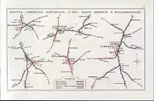
The Great Northern Railway main line from London to Peterborough had opened in 1850 including stations at Sandy and St. Neots. A station between these, named Tempsford, was opened on 1 January 1863.[1][2] It was located 47 miles 40 chains (76.4 km) from London King's Cross.[3]
The station closed on 5 November 1956.[2]
Potential reopening
In January 2019, the East West Railway company announced a number of options for a new route for the Bedford–Cambridge sector of their planned Oxford–Cambridge railway line.[4] In January 2020, the company announced that it had selected a route that would cross the ECML "in the Tempsford area", bypassing both Sandy railway station and St Neots railway station. It has not been decided if East West Rail will use the old location or a new site.[5]
Route
| Preceding station | Historical railways | Following station | ||
|---|---|---|---|---|
| Sandy Line and station open |
Great Northern Railway East Coast Main Line |
St. Neots Line and station open | ||
Notes
- Conolly 1976, p. 11, section C2.
- Butt 1995, p. 227.
- Yonge 2006, map 15C.
- "Have your say". eastwestrail.co.uk.
- "Bedford to Cambridge: The Preferred Route Option". East West Rail Ltd. 30 January 2020. Retrieved 19 February 2020.
References
- Butt, R.V.J. (1995). The Directory of Railway Stations. Yeovil: Patrick Stephens Ltd. ISBN 1-85260-508-1. R508.
- Conolly, W. Philip (January 1976). British Railways Pre-Grouping Atlas and Gazetteer (5th ed.). Shepperton: Ian Allan. ISBN 0-7110-0320-3. EX/0176.
- Yonge, John (September 2006) [1994]. Jacobs, Gerald (ed.). 2: Eastern. Railway Track Diagrams (3rd ed.). Bradford on Avon: Trackmaps. ISBN 0-9549866-2-8.