Tersky District, Kabardino-Balkarian Republic
Tersky District (Russian: Те́рский райо́н; Kabardian: Тэрч къедзыгъуэ; Karachay-Balkar: Терк район) is an administrative[1] and a municipal[4] district (raion), one of the ten in the Kabardino-Balkarian Republic, Russia. It is located in the east of the republic. The area of the district is 893.12 square kilometers (344.84 sq mi). Its administrative center is the town of Terek.[1] As of the 2010 Census, the total population of the district was 51,220, with the population of Terek accounting for 37.4% of that number.[2]
Tersky District
Терский район | |
|---|---|
| Other transcription(s) | |
| • Kabardian | Тэрч къедзыгъуэ |
| • Karachay-Balkar | Терк район |
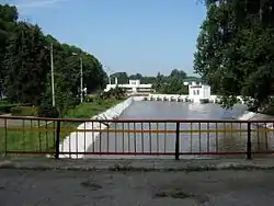 Dzhulat Malokabardinsky channel, Tersky District | |
.png.webp) Flag | |
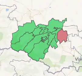
Location of Tersky District in the Kabardino-Balkarian Republic | |
| Coordinates: 43°29′N 44°08′E | |
| Country | Russia |
| Federal subject | Kabardino-Balkarian Republic[1] |
| Established | 1921 |
| Administrative center | Terek[1] |
| Area | |
| • Total | 893.12 km2 (344.84 sq mi) |
| Population | |
| • Total | 51,220 |
| • Estimate (2018)[3] | 50,671 (−1.1%) |
| • Density | 57/km2 (150/sq mi) |
| • Urban | 37.4% |
| • Rural | 62.6% |
| Administrative structure | |
| • Inhabited localities[1] | 1 Cities/towns, 26 Rural localities |
| Municipal structure | |
| • Municipally incorporated as | Tersky Municipal District[4] |
| • Municipal divisions[4] | 1 Urban settlements, 17 Rural settlements |
| Time zone | UTC+3 (MSK |
| OKTMO ID | 83635000 |
| Website | http://te.adm-kbr.ru |
| 2010 Census | 51,220[2] |
|---|---|
| 2002 Census | 52,976[6] |
| 1989 Census | 46,245[7] |
| 1979 Census | 42,814[8] |
Administrative and municipal status
Within the framework of administrative divisions, Tersky District is one of the ten in the Kabardino-Balkarian Republic and has administrative jurisdiction over one town (Terek) and twenty-six rural localities.[1] As a municipal division, the district is incorporated as Tersky Municipal District.[4] The town of Terek is incorporated as an urban settlement and the twenty-six rural localities are incorporated into seventeen rural settlements within the municipal district.[4] The town of Terek serves as the administrative center of both the administrative[1] and municipal[4] district.
References
Notes
- Law #12-RZ
- Russian Federal State Statistics Service (2011). "Всероссийская перепись населения 2010 года. Том 1" [2010 All-Russian Population Census, vol. 1]. Всероссийская перепись населения 2010 года [2010 All-Russia Population Census] (in Russian). Federal State Statistics Service.
- "26. Численность постоянного населения Российской Федерации по муниципальным образованиям на 1 января 2018 года". Federal State Statistics Service. Retrieved January 23, 2019.
- Law #13-RZ
- "Об исчислении времени". Официальный интернет-портал правовой информации (in Russian). June 3, 2011. Retrieved January 19, 2019.
- Russian Federal State Statistics Service (May 21, 2004). "Численность населения России, субъектов Российской Федерации в составе федеральных округов, районов, городских поселений, сельских населённых пунктов – районных центров и сельских населённых пунктов с населением 3 тысячи и более человек" [Population of Russia, Its Federal Districts, Federal Subjects, Districts, Urban Localities, Rural Localities—Administrative Centers, and Rural Localities with Population of Over 3,000] (XLS). Всероссийская перепись населения 2002 года [All-Russia Population Census of 2002] (in Russian).
- "Всесоюзная перепись населения 1989 г. Численность наличного населения союзных и автономных республик, автономных областей и округов, краёв, областей, районов, городских поселений и сёл-райцентров" [All Union Population Census of 1989: Present Population of Union and Autonomous Republics, Autonomous Oblasts and Okrugs, Krais, Oblasts, Districts, Urban Settlements, and Villages Serving as District Administrative Centers]. Всесоюзная перепись населения 1989 года [All-Union Population Census of 1989] (in Russian). Институт демографии Национального исследовательского университета: Высшая школа экономики [Institute of Demography at the National Research University: Higher School of Economics]. 1989 – via Demoscope Weekly.
- "Всесоюзная перепись населения 1979 г. Национальный состав населения по регионам России" [All Union Population Census of 1979. Ethnic composition of the population by regions of Russia] (XLS). Всесоюзная перепись населения 1979 года [All-Union Population Census of 1979] (in Russian). 1979 – via Demoscope Weekly (website of the Institute of Demographics of the State University—Higher School of Economics.
Sources
- Парламент Кабардино-Балкарской Республики. Закон №12-РЗ от 27 февраля 2005 г. «Об административно-территориальном устройстве Кабардино-Балкарской Республики», в ред. Закона №20-РЗ от 23 апреля 2014 г. «О внесении изменений в отдельные республиканские Законы». Вступил в силу на следующий день после опубликования. Опубликован: "Кабардино-Балкарская правда", б/н, 1 марта 2005 г. (Parliament of the Kabardino-Balkarian Republic. Law #12-RZ of February 27, 2005 On the Administrative-Territorial Structure of the Kabardino-Balkarian Republic, as amended by the Law #20-RZ of April 23, 2014 On Amending Various Republican Laws. Effective as of the day following the publication date.).
- Парламент Кабардино-Балкарской Республики. Закон №13-РЗ от 27 февраля 2005 г. «Об статусе и границах муниципальных образований в Кабардино-Балкарской Республики», в ред. Закона №20-РЗ от 23 апреля 2014 г. «О внесении изменений в отдельные республиканские Законы». Вступил в силу на следующий день после официального опубликования. Опубликован: "Кабардино-Балкарская правда", б/н, 1 марта 2005 г. (Parliament of the Kabardino-Balkarian Republic. Law #13-RZ of February 27, 2005 On the Status and the Borders of the Municipal Formations in the Kabardino-Balkarian Republic, as amended by the Law #20-RZ of April 23, 2014 On Amending Various Republican Laws. Effective as of the day following the official publication date.).