Thamarassery Churam
Thamarassery Churam is a mountain pass in Kerala, India across the Western Ghats. "Churam" is the Malayalam word for mountain pass. Hence, it is more prominently called Wayanad Churam.
| Thamarassery Churam | |
|---|---|
| Wayanad churam | |
 Viewpoint of Thamarassery churam | |
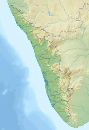
| Elevation | 800 m (2,625 ft) |
| Traversed by | NH766 |
| Location | India |
| Range | Western Ghats |
| Coordinates | 11°29′54″N 76°1′20″E |
 | |
History
The British used to transport spices from Wayanad to Beypore Port, Kozhikode via the Kuttiadi route. Between 1700 and 1750, they searched for a new route which could reduce the distance. For which, they sought the help of Karinthandan Moopan (chief), a tribal leader from the Paniya tribe in Wayanad. The route via the Thamarassery ghat was found with the help of Karinthandan.It is believed that he was later shot to death. However there is no solid evidence for this.[1] It is also believed that Karinthandan's ghost haunted the travellers for a while until it was nailed to a tree by a wizard. The mysterious chain tree is situated about 58 km from this ghat.
Geography
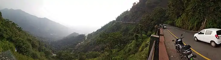
It is located around 800 meters above sea level along National Highway NH 766 in Kozhikode District. This area is a popular tourist destination that offers a unique blend of landscape, wildlife sanctuaries, waterfalls, dams, coffee plantations, beautiful hilltop view and varied flora and fauna. This mountain range connects the Kozhikode and Wayanad Districts. It lies within the Western Ghats that run parallel to the western coast of the Indian peninsula, located entirely in India. The highway has nine hairpin bends. Churam is about 14 kilometers in length, starting from Adivaram to Lakkidi View Point.[2]
References
- "Tribal hero of Thamarassery Ghat road gets a face | Kozhikode News". Times of India. Retrieved 2018-03-24.
- "Thamarassery (i), Kozhikode District, Kerala, India". Kerala Tourism. Retrieved 2018-03-24.