The Hitching Stone
The Hitching Stone is a gritstone erratic block on Keighley Moor, North Yorkshire, near Earl Crag and the village of Cowling.[1][2][3][4] It is very close to the border between North Yorkshire and West Yorkshire and the border between Yorkshire and Lancashire.[5]
| the Hitching Stone | |
|---|---|
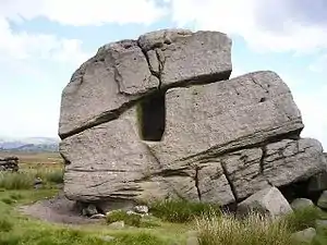
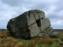 The Hitching Stone, showing the fissure and rectangular hole known as the druid’s chair | |
| Location | Earl Crag, Yorkshire |
| Nearest city | Bradford |
| Coordinates | 53.871513°N 2.021789°W |
| OS grid reference | SD9841 |
| Elevation | 1200 ft |
| Height | 21 ft |
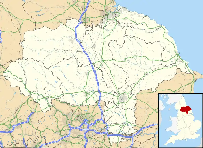 Location of the Hitching Stone in North Yorkshire | |
It is said to be the largest boulder in Yorkshire at 29 feet long, 25 feet wide and 21 feet high.[6] It is also said to weigh a lot more than 1000 tonnes.[5]
Geography
The Hitching Stone is 5 miles from the town of Keighley and is at an elevation of 1200 feet.[7]
History
The Hitching Stone and all the other erratic boulders on Keighley Moor were put in place thousands to possibly millions of years ago during the Pleistocene Epoch.[5][8] The Hitching Stone most likely originally came from Earl Crag during this time.[3] As a result of the fact that The Hitching Stone lies at the borders of historic counties, ancient councils and parliaments met at the stone and markets, fairs, and other gatherings were also held at the stone, with the last fair being held in 1870.[6][9]
Gallery
 The Hitching Stone
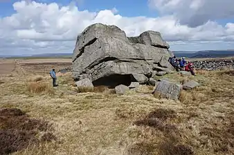 People visiting the Hitching Stone
_-_geograph.org.uk_-_427679.jpg.webp) The south side of the Hitching Stone
The south side of the Hitching Stone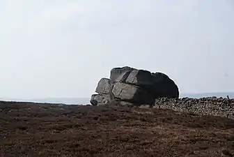 The Hitching Stone from the east
_-_geograph.org.uk_-_427687.jpg.webp) The pool of water in the Hitching Stone
The pool of water in the Hitching Stone
See also
References
- "The Hitching Stone". www.ukclimbing.com. Retrieved 2018-06-02.
- Map, The Megalithic Portal and Megalith. "Hitching Stone". The Megalithic Portal. Retrieved 2018-06-02.
- "Hitching Stone, Near Cowling, West Yorkshire". The Journal Of Antiquities. 2016-06-07. Retrieved 2018-06-03.
- Jarratt, Jim. "The Earl Crag Monuments". Ivory Towers and Dressed Stones.
- "Winter Hill Stone, Keighley Moor, West Yorkshire". The Journal Of Antiquities. 2014-09-14. Retrieved 2018-06-03.
- "On the Bradford District's Western Boundary". www.bradfordhistorical.org.uk. Retrieved 2018-06-02.
- Keighley, William; Holmes, Robert (1858). Keighley, past and present: or, An historical, topographical and statistical sketch of the town, parish and environs of Keighley, including Riddlesden, Marley, Hainworth, and some other places in the contiguous parish of Bingley ; likewise an account of the ancient families which have flourished therein, with a brief memoir of the Rev. Theodore Dury, M.A., late rector of Keighley. Keighley (England): Arthur Hall, Virtue & Company. p. 127.
at an elevation of 1,200 feet, and upwards of five miles from the town, stands an isolated and ponderous mass of coarse grit, called the ‘Hitching Stone,’
- Hansen, Bent. "Pleistocene - History of Earth's climate". www.dandebat.dk. Retrieved 2018-06-03.
- Paul., Bennett (2003). The old stones of Elmet. Somerset: Capall Bann Publishing. ISBN 9781861631343. OCLC 961022287.
Further reading
- T. Sharpe, The Pendle Zodiac, Thomas Sharpe, February 20, 2012. Exploring the Sacred Geometry, Ley alignments and recent Landscape Zodiac discoveries of Pendle - in the Rose County of Lancashire - from the perspective of Spiritual Science.