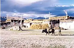
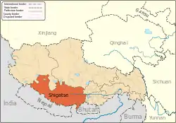
Tingri County
Tingri County or Dhringgri County (Tibetan: དིང་རི་རྫོང་།, Wylie: ding ri rdzong, ZYPY: Tingri Zong ; Chinese: 定日县; pinyin: Dìngrì Xiàn), is a county under the administration of the prefecture-level city of Xigazê in the Tibet Autonomous Region of China.
Tingri County
定日县 • དིང་རི་རྫོང་། | |
|---|---|
 | |
.png.webp) Location of Tingri County (red) within Xigazê City (yellow) and the Tibet Autonomous Region | |
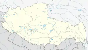 Tingri County Location of the seat in the Tibet Autonomous Region | |
| Coordinates (Tingri County government, Shelkar): 28°39′32″N 87°07′34″E | |
| Country | People's Republic of China |
| Autonomous region | Tibet |
| Prefecture-level city | Xigazê |
| Seat | Shelkar |
| Time zone | UTC+8 (China Standard) |
The county comprises the upper valley of the Bum-chu or Arun River, with the valleys of its tributaries plus the valleys of the Rongshar Tsangpo and the Lapchi Gang Tsanpo which flow south into Nepal. It is bordered on the south by the main range of the Himalayas including Mount Everest (Tib. Chomolungma), Makalu and Cho Oyu. The present county administration is located at Shelkar, about 87 km (54 mi) east of Tingri (town).[1]
It is one of the four counties that comprise the Qomolangma National Nature Preserve (Tingri, Dinjie, Nyalam, and Kyirong).[2]
Towns and townships
- Shelkar Town (ཤེལ་དཀར་, 协格尔镇)
- Gangga Town (སྒང་དགའ་, 岗嘎镇)
- Qutang Township (ཆུ་ཐང་, 曲当乡)
- Tashi Dzom Township (བཀྲ་ཤིས་འཛོམས་, 扎西宗乡)
- Kaimar Township (གད་དམར་, 克玛乡)
- Ronxar Township (རོང་ཤར་, 绒辖乡)
- Cogo Township (མཚོ་སྒོ་, 措果乡)
- Qulho Township (ཆུ་ལྷོ་, 曲洛乡)
- Chamco Township (གྲམ་མཚོ་, 长所乡)
- Nyixar Township (ཉི་ཤར་, 尼辖乡)
- Zagor Township (རྩ་སྐོར་, 扎果乡)
- Pain'gyi Township (ཕན་སྐྱིད་, 盆吉乡)
- Gyaco Township (བརྒྱ་ཚོ་, 加措乡)
Transport
Footnotes
- Footprint Tibet Handbook with Bhutan, p. 296. 2nd edition (1999). Gyume Dorje. Footprint Handbooks, Bath, England. ISBN 1-900949-33-4.
- Department of Forestry, Government of the Tibet Autonomous Region, People's Republic of China, ‘’Report on Protected Lands in the Tibet Autonomous Region’’ Lhasa: Tibet Autonomous Region Government Publishing House, 2006
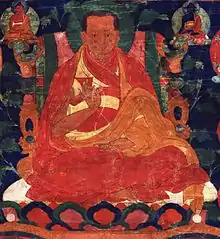
- Gardener, Alexander (2010). "Zhangton Chobar". The Treasury of Lives. Retrieved 2017-07-24.
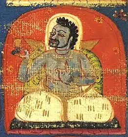
- Sorensen, Michelle (2011). "Padampa Sanggye". The Treasury of Lives. Retrieved 2017-07-24.
- "The Tingri Hundred". Tibetological. Retrieved 2017-07-24.
- "ding ri glang 'khor". Rangjung Yeshe Wiki - Dharma Dictionnary. 2005. Retrieved 2017-07-24.
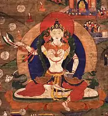
- "Dingri Langkhor". The Treasury of Lives. Retrieved 2017-07-24.
- Sorenson, Michelle (2010). "Machik Labdron". The Treasury of Lives. Retrieved 2017-07-24.
Further reading
- Annals of Tingri County (in Chinese)
| County-level divisions |
|  | ||||
|---|---|---|---|---|---|---|
| Settlements | ||||||
| Landmarks | ||||||
| Geography | ||||||
| Transport |
| |||||
| Authority control |
|
|---|