Togwotee Pass
Togwotee Pass (pronounced toe'-ga-tee) (el. 9,655 feet (2,943 m)) is a mountain pass located on the Continental Divide in the Absaroka Mountains of the United States, between the towns of Dubois and Moran Junction, Wyoming in the Jackson Hole valley.[1]
| Togwotee Pass | |
|---|---|
 Togwotee Pass from north, from Breccia Peak, Two Oceans Mountain on the right | |
| Elevation | 9,658 ft (2,944 m) |
| Traversed by | U.S. Highway 287/U.S. Highway 26 |
| Location | Teton County, Wyoming, United States |
| Range | Absaroka Range |
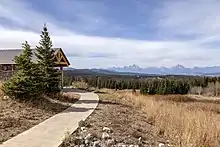
U.S. Highway 287 and U.S. Highway 26 cross the pass, which is located approximately 25 miles (40 km) east of Moran Junction. The pass provides the most direct access to Grand Teton National Park from eastern Wyoming. Located between Two Ocean Mountain[2] and Breccia Peak,[3] sweeping vistas of the Teton Range are visible from the western slopes of the pass. A ski run (mainly a traverse) at the Jackson Hole ski resort is also named Togwotee Pass.
The pass is located in the Bridger-Teton National Forest and adjacent to Shoshone National Forest. The pass receives heavy winter snowfall and is a top destination for snowmobiling and cross-country skiing. Snowfall at the pass often exceeds 25 feet (760 cm) (reports of over 50 feet (15 m) of snow are also known) in any given winter and the road can be shut down for days at a time during blizzards. The Continental Divide Snowmobile Trail passes through the immediate area.
History
The pass is named for Togwotee, a subchief under Chief Washakie of the Sheepeater tribe, a branch of the Shoshones. Togwotee led The Jones Expedition over this pass in 1873.[4][5] Before the expedition, the pass was reported to be a important trade route for native tribes.[6]
External links
References
- "Togwotee Pass". Geographic Names Information System. United States Geological Survey. Retrieved 2018-11-07.
- "Two Oceans Mountain : Climbing, Hiking & Mountaineering : SummitPost". summitpost.org. Retrieved February 14, 2012.
- "Breccia Peak - Wyoming, United States". peakery.com. Retrieved February 14, 2012.
- Jones, William A. (1875). THE RECONNAISSANCE Of NORTHWESTERN WYOMING INCLUDING YELLOWSTONE NATIONAL PARK. U.S. Government Printing Office. p. 1. ISBN 0331948184.
- Sanborn, Margaret (1978). The Grand Tetons : the story of the men who tamed the western wilderness. New York : Putnam. p. 267. ISBN 0399120459.
- Sanborn, Margaret (1978). The Grand Tetons : the story of the men who tamed the western wilderness. New York : Putnam. p. 38. ISBN 0399120459.