Moran, Wyoming
Moran (also Moran Junction) is an unincorporated community in south central Teton County, Wyoming, United States, which serves as one of the principal fee collection entrances to Grand Teton National Park. It lies in Grand Teton National Park northeast of the city of Jackson, the county seat of Teton County, at the intersection of U.S. Routes 26, 89, 191 and 287.[2] Its elevation is 6,749 feet (2,057 m). As the community has had two different names, the Board on Geographic Names officially ruled in favor of "Moran" in 1970.[1] Although Moran is unincorporated, it has a post office, with the ZIP code of 83013.[3]
Moran | |
|---|---|
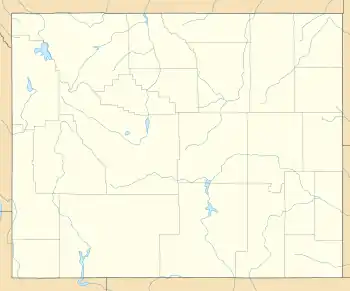 Moran Location within the state of Wyoming  Moran Moran (the United States) | |
| Coordinates: 43°50′30″N 110°30′28″W | |
| Country | United States |
| State | Wyoming |
| County | Teton |
| Elevation | 6,749 ft (2,057 m) |
| Time zone | UTC-7 (Mountain (MST)) |
| • Summer (DST) | UTC-6 (MDT) |
| ZIP codes | 83013 |
| GNIS feature ID | 1604433[1] |
Moran is part of the Jackson, WY–ID Micropolitan Statistical Area and it is known as the state's coldest continuously inhabited place, with a record low of -63 °F (-52 °C) registered in the winter of 1933. The high altitude at which the village is located, as well as the effects of radiational cooling, cause particularly severe conditions in the winter.
Education
Public education in the community of Moran is provided by Teton County School District #1. Schools serving the community include Moran Elementary School (grades K-5), Jackson Hole Middle School (grades 6-8), and Jackson Hole High School (grades 9-12).
History
Ed "Cap" and Clara Smith established a homestead at Moran in the 1890s, but found themselves catering to travelers on the road to Yellowstone National Park to the north, or to Idaho on the Marysville Road. The Smiths built a two story log hotel. Their neighbors, the Allens, built the Elkhorn Hotel, which housed the post office and a store.[4] The Smith hotel burned around November 1900.[5]
Moran began to grow after 1903, when Ben D. Sheffield bought two homesteads on the Snake River and built up an outfitting business at the location, called the Teton Lodge Resort. A toll bridge over the Snake, possibly operated by Sheffield, was a major link in the local transportation network. Sheffield also operated the Moran post office from 1907 to 1919. His brother Edward ran the Flagg Ranch farther north, just outside Yellowstone National Park. The Sheffield ranch's lodge, which housed the post office, burned in 1916. A replacement lodge was built circa 1922. The Sheffield complex of cabins comprised the bulk of the town. In 1928, Sheffield sold out to the Snake River Land Company (SRLC), which renovated and expanded the facility, in part to head off new development in the area. The SRLC established the Teton Lodge Company to operate the ranch, which expanded to a capacity of 200 guests. The main lodge was destroyed by fire in 1935. The remaining cabins, and thus most of the community, were moved to Jackson Lake Lodge in 1955.[6]
The construction of Jackson Lake Dam from 1910 to 1916 temporarily made Moran a much larger town, with a construction encampment built by the Reclamation Service to the north of the Sheffield ranch.[5]
During the location shooting of 1930’s The Big Trail, the cast and crew travelled to Wyoming. The location was quite primitive and the only lodging available to them were a couple of trappers cabins. The crew set about building more cabins (which would be needed for specific scenes as well as lodging), and John Wayne helped build some of those cabins. The site later became the town of Moran.
Climate
Moran experiences a subarctic climate (Dfc) due to its high elevation and aridity, with cold snowy winters, and generally warm summers with nights still dropping to near-freezing temperatures.
The data below were compiled from 1911 to when this chart was created (July 2018). They were accessed via the WRCC.[7]
| Climate data for Moran, WY | |||||||||||||
|---|---|---|---|---|---|---|---|---|---|---|---|---|---|
| Month | Jan | Feb | Mar | Apr | May | Jun | Jul | Aug | Sep | Oct | Nov | Dec | Year |
| Record high °F (°C) | 51 (11) |
60 (16) |
62 (17) |
74 (23) |
82 (28) |
92 (33) |
93 (34) |
92 (33) |
87 (31) |
80 (27) |
64 (18) |
53 (12) |
93 (34) |
| Average high °F (°C) | 25.5 (−3.6) |
31.3 (−0.4) |
38.6 (3.7) |
47.8 (8.8) |
58.1 (14.5) |
67.9 (19.9) |
77.6 (25.3) |
76.1 (24.5) |
66.6 (19.2) |
53.9 (12.2) |
37.1 (2.8) |
27.0 (−2.8) |
50.6 (10.3) |
| Average low °F (°C) | −1.5 (−18.6) |
0.7 (−17.4) |
8.0 (−13.3) |
19.6 (−6.9) |
29.0 (−1.7) |
35.7 (2.1) |
39.9 (4.4) |
38.1 (3.4) |
31.0 (−0.6) |
23.6 (−4.7) |
13.2 (−10.4) |
2.4 (−16.4) |
20.0 (−6.7) |
| Record low °F (°C) | −52 (−47) |
−63 (−53) |
−43 (−42) |
−28 (−33) |
5 (−15) |
18 (−8) |
23 (−5) |
19 (−7) |
7 (−14) |
−11 (−24) |
−28 (−33) |
−50 (−46) |
−63 (−53) |
| Average precipitation inches (mm) | 2.88 (73) |
2.27 (58) |
2.13 (54) |
1.92 (49) |
2.04 (52) |
1.73 (44) |
1.10 (28) |
1.27 (32) |
1.52 (39) |
1.62 (41) |
2.36 (60) |
2.62 (67) |
23.46 (597) |
| Average snowfall inches (cm) | 34.0 (86) |
23.6 (60) |
20.4 (52) |
9.1 (23) |
2.6 (6.6) |
0.4 (1.0) |
0 (0) |
0 (0) |
1.1 (2.8) |
4.8 (12) |
19.2 (49) |
30.0 (76) |
145.2 (368.4) |
| Source: https://wrcc.dri.edu/cgi-bin/cliMAIN.pl?wy6440 | |||||||||||||
References
- "Moran, Wyoming". Geographic Names Information System. United States Geological Survey. Retrieved 2008-05-02.
- Rand McNally. The Road Atlas '08. Chicago: Rand McNally, 2008, p. 116.
- Zip Code Lookup
- "Chapter 6: The Pioneers: Homesteading in Jackson Role, 1884-1900". A Place Called Jackson Hole: A Historic Resource Study of Grand Teton National Park. 2008-08-12. Retrieved April 27, 2011.
- "Chapter 13: The Communities of Jackson Hole". A Place Called Jackson Hole: A Historic Resource Study of Grand Teton National Park. National Park Service. 2008-08-12. Retrieved April 19, 2011.
- "Chapter 15: Tourists". A Place Called Jackson Hole: A Historic Resource Study of Grand Teton National Park. National Park Service. 2008-08-12. Retrieved April 19, 2011.
- "MORAN 5 WNW, WYOMING - Climate Summary". wrcc.dri.edu. Retrieved 2018-07-25.
Municipalities and communities of Teton County, Wyoming, United States | ||
|---|---|---|
| Town | 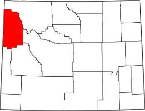 | |
| CDPs | ||
| Unincorporated communities | ||
| ||