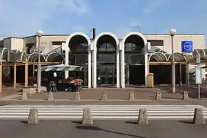
Torcy station
Torcy (French pronunciation: [toʁsi]) is a railway station in Torcy, Seine-et-Marne, a suburb east of Paris.
Torcy | |||||||||||
|---|---|---|---|---|---|---|---|---|---|---|---|
| RER station | |||||||||||
 | |||||||||||
| Location | 1 Place de la Gare 77200 Torcy France | ||||||||||
| Coordinates | 48.8394°N 2.6547°E | ||||||||||
| Owned by | RATP Group | ||||||||||
| Operated by | RATP Group | ||||||||||
| Line(s) | |||||||||||
| Platforms | 2 | ||||||||||
| Tracks | 3 | ||||||||||
| Other information | |||||||||||
| Station code | 87758375 | ||||||||||
| Fare zone | 5 | ||||||||||
| History | |||||||||||
| Opened | 19 December 1980 | ||||||||||
| Passengers | |||||||||||
| 2015 | 3,852,727 | ||||||||||
| Services | |||||||||||
| |||||||||||
History
Torcy opened on 19 December 1980 as part of an extension of the A4 branch from its previous eastern terminal of Noisy-le-Grand–Mont d'Est. It served as the eastern terminus of the A4 branch for twelve years until 1 April 1992, when the RER A4 was extended to Marne-la-Vallée–Chessy; since then, the A4 branch has yet to be extended.
Traffic
According to RATP, 13,716 passengers used Torcy each day in 2006 for a total of 5,006,340 passengers annually.[1]
Service
Torcy is on the A4 branch of the RER A and receives frequent service. As of 4 February 2008, during peak hours there are between twelve and eighteen trains per hour (intervals of five and three minutes and twenty seconds), during mid-day trains arrive every ten minutes, and early mornings and late nights trains come at fifteen-minute intervals.[2][3]
The station acts as a terminus for certain trains. Trains that terminate at Torcy will display a headline beginning with O, O being the designation that a train terminates at Torcy rather than Q for Marne-la-Vallée–Chessy.[3]
Bus connections
The station is served by several buses:
 RATP Bus network lines: 211, 220, 321 and 421 ;[4][5]
- Pep's Bus network lines: 13, 21, 25, 29 and 46 ;[4][5]
- Seine-et-Marne Express Bus network lines: 18 and 19 ;[4][5]
- Stigo Bus network line: 18 ;[4][5]
- Transdev Lys (by Setra) Bus network line: 100 ;[4][5]
 Noctilien network night bus lines: N34 and N130.[5][6]
Gallery
| Wikimedia Commons has media related to Gare de Torcy. |
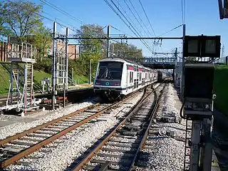 A train leaving Torcy for Marne-la-Vallée–Chessy
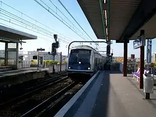 An OKEY train that has terminated at Torcy
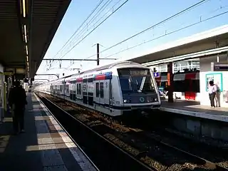 A QYEN train bound for Marne-la-Vallée–Chessy
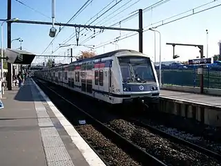 A westbound train going to Poissy
References
- (in French) Comité de pôle de Noisiel Archived 27 November 2008 at the Wayback Machine Iris Conseil Retrieved 30 December 2008
- RER A timetable towards Cergy-le-Haut RATP Retrieved 24 December 2008
- RER A timetable towards Marne-la-Vallée–Chessy RATP Retrieved 24 December 2008
- "Plan du réseau de bus à Marne-la-Vallée (Secteur n°11)" [Map of the RATP bus network in Marne-la-Vallée (Sector n° 11).] (PDF). Ratp.fr (Color map showing the names of bus stops and main streets.) (in French). RATP Group. May 2020. Retrieved 19 August 2020.
- "Plan du réseau de bus à Marne-la-Vallée (Secteur n°45)" [Map of the bus networks in Marne-la-Vallée (Sector n° 45).] (PDF). Transdev-idf.com (Color map showing the names of bus stops and main streets.) (in French). Île-de-France Mobilités. January 2020. Retrieved 23 August 2020.
- "Plan du réseau Noctilien (2017) - (Secteur : Paris & Sud-Est)" [Map of the night bus (Noctilien) network (2017) - (Sector: Paris and its south-eastern suburbs).] (PDF). Ratp.fr (Color map showing the names of the bus stops and the cities served.) (in French). RATP Group. April 2017. Retrieved 19 August 2020.