Toston, Montana
Toston is a census-designated place (CDP) in Broadwater County, Montana, United States. The population was 108 at the 2010 census.[1]
Toston, Montana | |
|---|---|
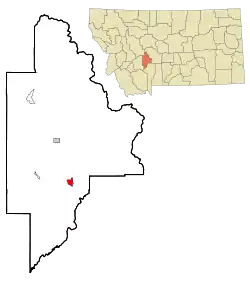 Location of Toston, Montana | |
| Coordinates: 46°10′19″N 111°26′43″W | |
| Country | United States |
| State | Montana |
| County | Broadwater |
| Area | |
| • Total | 2.8 sq mi (7.3 km2) |
| • Land | 2.6 sq mi (6.7 km2) |
| • Water | 0.2 sq mi (0.6 km2) |
| Elevation | 3,917 ft (1,194 m) |
| Population (2010) | |
| • Total | 108 |
| • Density | 41/sq mi (16.0/km2) |
| Time zone | UTC-7 (Mountain (MST)) |
| • Summer (DST) | UTC-6 (MDT) |
| ZIP codes | 59641, 59643 |
| Area code(s) | 406 |
| FIPS code | 30-74500 |
| GNIS feature ID | 0777714 |
Geography
Toston is located at 46°10′19″N 111°26′43″W (46.172047, -111.445345).[2]
According to the United States Census Bureau, the CDP has a total area of 2.8 square miles (7.3 km2), of which 2.6 square miles (6.7 km2) is land and 0.23 square miles (0.6 km2), or 8.35%, is water.[1]
Demographics
As of the census[3] of 2000, there were 105 people, 44 households, and 28 families residing in the CDP. The population density was 58.5 people per square mile (22.6/km2). There were 51 housing units at an average density of 28.4 per square mile (11.0/km2). The racial makeup of the CDP was 94.29% White, 0.95% Native American, and 4.76% from two or more races.
There were 44 households, out of which 27.3% had children under the age of 18 living with them, 56.8% were married couples living together, 6.8% had a female householder with no husband present, and 34.1% were non-families. 29.5% of all households were made up of individuals, and 6.8% had someone living alone who was 65 years of age or older. The average household size was 2.39 and the average family size was 2.97.
In the CDP, the population was spread out, with 25.7% under the age of 18, 4.8% from 18 to 24, 26.7% from 25 to 44, 35.2% from 45 to 64, and 7.6% who were 65 years of age or older. The median age was 40 years. For every 100 females, there were 118.8 males. For every 100 females age 18 and over, there were 122.9 males.
The median income for a household in the CDP was $21,250, and the median income for a family was $22,778. Males had a median income of $16,000 versus $0 for females. The per capita income for the CDP was $11,945. There were 26.5% of families and 42.2% of the population living below the poverty line, including 100.0% of under eighteens and 47.1% of those over 64.
References
- "Geographic Identifiers: 2010 Demographic Profile Data (G001): Toston CDP, Montana". U.S. Census Bureau, American Factfinder. Archived from the original on February 12, 2020. Retrieved June 26, 2013.
- "US Gazetteer files: 2010, 2000, and 1990". United States Census Bureau. 2011-02-12. Retrieved 2011-04-23.
- "U.S. Census website". United States Census Bureau. Retrieved 2008-01-31.
Municipalities and communities of Broadwater County, Montana, United States | ||
|---|---|---|
| City | 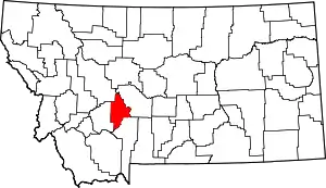 Broadwater County map | |
| CDPs | ||
| Unincorporated community | ||
| ||