Trnovec, Kočevje
Trnovec (pronounced [təɾˈnoːʋəts]; German: Tiefenreuther[2] or Tiefenreuter[3]) is a settlement in the hills northeast of the town of Kočevje in southern Slovenia. It was a village inhabited by Gottschee Germans. At the start of the Second World War its original population was evicted. The area is part of the traditional region of Lower Carniola and is now included in the Southeast Slovenia Statistical Region.[4]
Trnovec | |
|---|---|
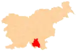
 Trnovec Location in Slovenia | |
| Coordinates: 45°40′29.96″N 14°59′34.99″E | |
| Country | |
| Traditional region | Lower Carniola |
| Statistical region | Southeast Slovenia |
| Municipality | Kočevje |
| Area | |
| • Total | 21.38 km2 (8.25 sq mi) |
| Elevation | 801.9 m (2,630.9 ft) |
| Population (2002) | |
| • Total | 6 |
| [1] | |
Name
Trnovec was attested in historical sources as Tieffenreutter in 1574.[5] After the Second World War, the settlement of Trnovec was administratively combined with Podstenice and shared that name. It was separated again from Podstenice in 1988 and Trnovec was reestablished as a separate settlement.[6]
Church
The local church, dedicated to the Virgin Mary, was a late Gothic building that was burned down in 1942 during the Second World War.[7]
Mass graves
Trnovec is the site of three known mass graves associated with the Second World War. The Rog Sawmill Mass Grave (Slovene: Grobišče pri Žagi Rog) is located on the edge of the woods on the left side of Rog Road, at a large pile of sawdust. The remains of unknown victims were found at the site in 1989.[8] The Larch Hill Cave Mass Grave (Grobišče Jama pod Macesnovo gorico) is located on a heavily karstified ridge 150 meters (490 ft) north of Rog Road and 900 meters (3,000 ft) southwest of Larch Hill (Macesnova gorica). It contains the remains of a large number of Home Guard troops and soldiers of other nationalities that were turned over to the Yugoslav authorities after the war and murdered.[9] The Larch Hill Rock Shelter Mass Grave (Grobišče Spodmol pri Macesnovi gorici) lies on the southwest edge of a shallow sinkhole in the middle of a wooded leveled karstified area southwest of Larch Hill. It contains the remains of one or more unknown victims that probably fled to the rock shelter during the war or during the killing at Larch Hill Cave.[10]
References
- Statistical Office of the Republic of Slovenia
- Leksikon občin kraljestev in dežel zastopanih v državnem zboru, vol. 6: Kranjsko. 1906. Vienna: C. Kr. Dvorna in Državna Tiskarna, p. 38.
- Ferenc, Mitja. 2007. Nekdanji nemški jezikovni otok na kočevskem. Kočevje: Pokrajinski muzej, p. 4.
- Kočevje municipal site
- "Trnovec". Slovenska historična topografija. ZRC SAZU Zgodovinski inštitut Milka Kosa. Retrieved December 29, 2020.
- Spremembe naselij 1948–95. 1996. Database. Ljubljana: Geografski inštitut ZRC SAZU, DZS.
- Slovenian Ministry of Culture register of national heritage reference number ešd 2813
- Ferenc, Mitja (December 2009). "Grobišče pri Žagi Rog". Geopedia (in Slovenian). Ljubljana: Služba za vojna grobišča, Ministrstvo za delo, družino in socialne zadeve. Retrieved May 6, 2020.
- Ferenc, Mitja (December 2009). "Grobišče Jama pod Macesnovo gorico". Geopedia (in Slovenian). Ljubljana: Služba za vojna grobišča, Ministrstvo za delo, družino in socialne zadeve. Retrieved May 6, 2020.
- Ferenc, Mitja (December 2009). "Grobišče Spodmol pri Macesnovi gorici". Geopedia (in Slovenian). Ljubljana: Služba za vojna grobišča, Ministrstvo za delo, družino in socialne zadeve. Retrieved May 6, 2020.