Trotuș
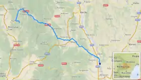
The Trotuș (Hungarian: Tatros) is a river in eastern Romania, a right tributary of the river Siret.[1][2][3] It emerges from the Ciuc Mountains in the Eastern Carpathians and joins the Siret after passing through Comănești and Onești in Bacău County. The total length of the Trotuș from its source to its confluence with the Siret is 162 km (101 mi).[2][4] Its basin area is 4,456 km2 (1,720 sq mi).[2][4][5]
| Trotuș Tatros | |
|---|---|
 The river Trotuș in Târgu Trotuș, Bacău County | |
 | |
| Location | |
| Country | Romania |
| Counties | Harghita, Bacău, Vrancea |
| Towns | Comănești, Onești |
| Physical characteristics | |
| Source | Ciuc Mountains |
| Mouth | Siret |
• location | Adjud |
• coordinates | 46°00′40″N 27°12′33″E |
| Length | 162 km (101 mi) |
| Basin size | 4,456 km2 (1,720 sq mi) |
| Basin features | |
| Progression | Siret→ Danube→ Black Sea |
| Tributaries | |
| • left | Asău, Tazlău |
| • right | Uz |
Towns and villages
The following towns and villages are situated along the river Trotuș, from source to mouth: Lunca de Sus, Lunca de Jos, Ghimeș-Făget, Palanca, Agăș, Comănești, Dărmănești, Târgu Ocna, Onești, Adjud.
Tributaries
The following rivers are tributaries to the river Trotuș (from source to mouth):[2]
Left: Gârbea, Valea Întunecoasă, Antaloc, Valea Rece, Bolovăniș, Tărhăuș, Șanț, Cuchiniș, Brusturoasa, Caminca, Șugura, Dracău, Agăș, Seaca, Ciungi, Asău, Urmeniș, Plopul, Larga, Cucuieți, Vâlcele, Gălian, Caraclău, Tazlău, Pârâul Mare
Right: Comiat, Bothavaș, Ugra, Boroș, Valea Capelei, Aldămaș, Popoiul, Ciugheș, Cotumba, Grohotiș, Sulța, Ciobănuș, Șopan, Uz, Dofteana, Slănic, Nicorești, Oituz, Cașin, Găureana, Gutinaș, Bogdana, Gârbovana, Căiuți, Popeni, Bâlca, Domoșița
References
- "Planul național de management. Sinteza planurilor de management la nivel de bazine/spații hidrografice, anexa 7.1" (PDF, 5.1 MB). Administrația Națională Apele Române. 2010. pp. 905–906.
- Atlasul cadastrului apelor din România. Partea 1 (in Romanian). Bucharest: Ministerul Mediului. 1992. pp. 402–411. OCLC 895459847. River code: XII.1.69
- Ovidiu Gabor - "Economic Mechanism in Water Management" (PDF). Archived from the original (PDF) on 5 March 2009. Retrieved 2009-03-05., map page 10
- Planul de management al spațiului hidrografic Siret, Administrația Națională Apele Române, page 17
- 2017 Romanian Statistical Yearbook, p. 13